Close Eye on the Texas and Louisiana Coasts….
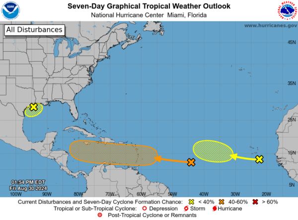
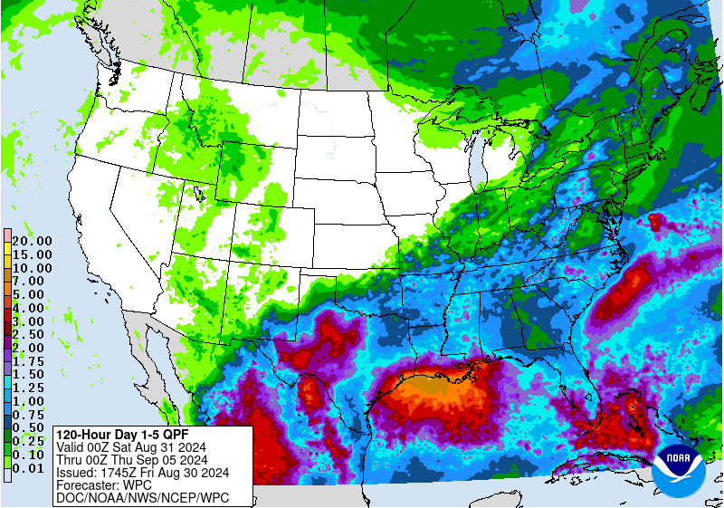
The NHC is now highlighting an area of low pressure over the northwestern Gulf of Mexico. This system has been meandering offshore helping to draw in copious amounts of tropical moisture throughout portions of the Gulf Coast and Lower Mississippi Valley. This system is expected to hang out in this area for the next several days and there could be slow development especially if the system stays offshore. There will be big impacts no matter what across this area with torrential rain and the risk of flooding. There have already been slow-moving storms today enhancing flooding in the New Orleans area.
Street flooding at Lake and London Avenue https://t.co/GtNqVkmAJp pic.twitter.com/mz4rCe47E9
— WWL-TV (@WWLTV) August 30, 2024
Storm causes flooding in New Orleans’ neighborhoods. Sign up for the Newswire: https://t.co/wc8jPzz1Tf pic.twitter.com/AeOeEGRTjk
— Storyful (@Storyful) May 13, 2017
Meanwhile, we still have a disorganized area of showers and storms in the central Atlantic and that still has a 40% chance of development over 7 days. Could have a tropical depression sometime next week.
The other wave is still hanging on between the west coast of Africa and Cabo Verde Islands. 20 percent chance for development over the next week.


