
(Cancelled as of 613pm) New Severe Thunderstorm Warning for Central Jefferson County until 645pm CDT
613pm CDT Update: The storm over Jefferson County is weakening and the warning has been dropped early.
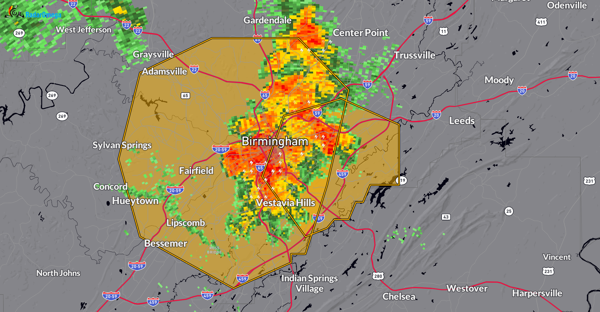
It is a large, slow-moving severe storm having a big impact on the Birmingham Metro. A new warning has been issued as this storm crawls at 5 mph to the west. 60 mph wind gust possible. Numerous reports of frequent lightning and torrential rain. You may want to delay heading out just a bit until this eases.
The only other storm is below severe limits, near Dora.
The National Weather Service in Birmingham has issued a
* Severe Thunderstorm Warning for…
Central Jefferson County in central Alabama…
* Until 645 PM CDT.
* At 555 PM CDT, a severe thunderstorm was located over southwestern
Birmingham, moving west at 5 mph.
HAZARD…60 mph wind gusts.
SOURCE…Radar indicated.
IMPACT…Expect damage to roofs, siding, and trees.
* Locations impacted include…
Birmingham, Hoover, Vestavia Hills, Bessemer, Homewood, Mountain
Brook, Hueytown, Gardendale, Irondale, Fairfield, Fultondale,
Pleasant Grove, Tarrant, Midfield, Adamsville, Brighton, Lipscomb,
Graysville, Sylvan Springs, and Brookside.
Category: Alabama's Weather, ALL POSTS, Severe Weather
About the Author (Author Profile)
Subscribe
If you enjoyed this article, subscribe to receive more just like it.


