Midday Nowcast: Drier Air Mass Settling into Alabama
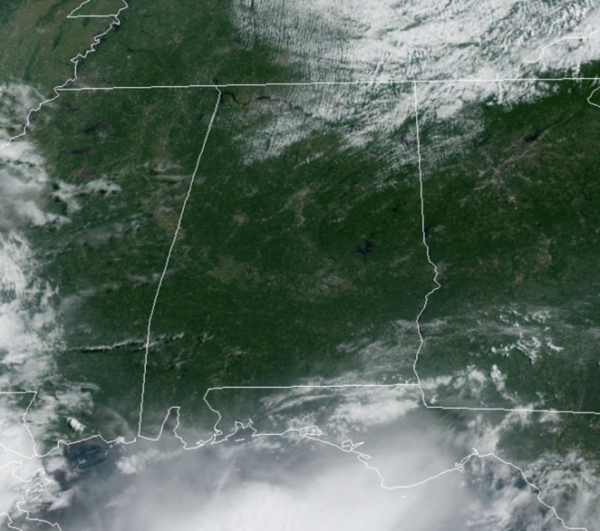
Today, we are seeing plenty of sunshine with highs in the lower 90s. However, an air mass change for Alabama means we are in store for some terrific weather, especially for August, the rest of this week across Alabama. A much drier air mass is moving into the state, dropping our humidity levels and bringing down our temperatures.
BIRMINGHAM ALMANAC: For August 19th, the average high for Birmingham is 91° and the average low is 71°. The record high is 103° set in 1999, while the record low is 62° set in 1992. We average 0.14” of precipitation on this date, and the record value is 2.46” set in 1901.
REST OF WEEK: The weather will be dry with lower humidity and cooler nights. For the northern third of the state, highs will be in the mid to upper 80s through the week, with lows well down in the 60s. Many communities will dip into the 50s early Wednesday morning for a nice preview of fall. For the southern counties, highs will be in the low 90s, but the lower humidity levels will make the summer heat feel more comfortable.
WEEKEND WEATHER: The pattern will not change much, and the weekend looks great as well. It will be generally dry with only isolated showers across the southern counties. Highs will be mostly in the low 90s Saturday and Sunday, and with the lower humidity levels it will remain tolerable for late August.
NEXT WEEK: Heat levels rise, and afternoon temperatures go back in the mid 90s next week. And, the pattern continues to look dry with only isolated showers.
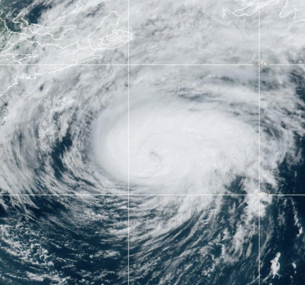
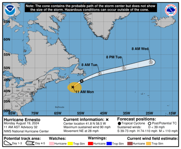
HURRICANE ERNESTO: At 1100 AM AST, the center of Hurricane Ernesto was located near latitude 41.8 North, longitude 58.5 West. Ernesto is moving toward the northeast near 28 mph. A turn toward the northeast and east-northeast with an increase in forward speed is expected during the next couple of days. On the forecast track, the center of Ernesto will pass near southeastern Newfoundland tonight and early Tuesday.
Maximum sustained winds are near 90 mph with higher gusts. Weakening is forecast, and Ernesto is expected to become a post-tropical cyclone by early Tuesday. Hurricane-force winds extend outward up to 35 miles from the center and tropical-storm-force winds extend outward up to 220 miles. The estimated minimum central pressure is 968 mb (28.59 inches).
The rest of the Atlantic remains quiet as Saharan Dust continues to limit tropical cyclone development for now.
WORLD TEMPERATURE EXTREMES: Over the last 24 hours, the highest observation outside the U.S. was 123.1F at Basrah-Hussen, Iraq. The lowest observation was -87.0F at Amundsen-Scott South Pole Station, Antarctica.
CONTIGUOUS TEMPERATURE EXTREMES: Over the last 24 hours, the highest observation was 114F at Death Valley, CA. The lowest observation was 28F at Kirk, OR.
Category: Alabama's Weather, ALL POSTS


