Scattered Strong Storms Tomorrow/Sunday; Cooler Next Week
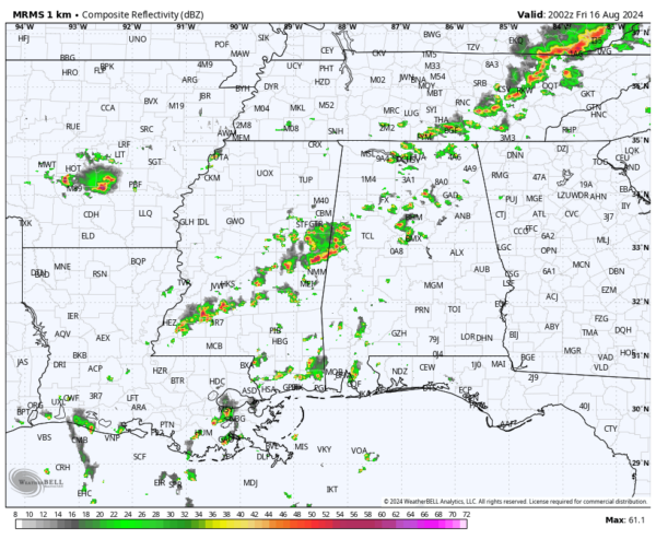
RADAR CHECK: As expected, we have widely scattered showers and strong thunderstorms across Alabama at mid-afternoon. So far storms have remained below severe limits, and away from the storms temperatures are in the 90s with a partly sunny sky. Scattered showers and storms will fade tonight after sunset.
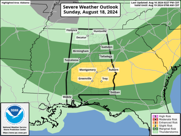
The front will drift southward over the weekend, and scattered showers and storms remain possible tomorrow and Sunday. Again, rain coverage will be spotty, but heavier thunderstorms both days could produce strong winds. A “marginal risk” (level 1/5) is defined for the northern counties of Alabama tomorrow, and much of the state Sunday. We do note SPC has added a “slight risk” (level 2/5) for parts of South/Central Alabama Sunday.
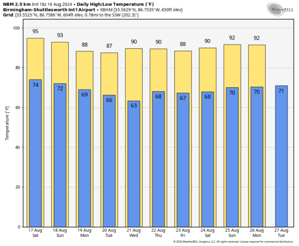
Stronger storms will come during the afternoon and evening hours, but a morning shower can’t be ruled out in a few places. Highs over the weekend will be mostly in the low to mid 90s.
NEXT WEEK: A very refreshing airmass for August will drop into the Deep South with lower humidity and cooler nights. Highs drop into the upper 80s over North Alabama for most of the week, with lows in the 60s. Cooler spots will likely dip into the 50s early Tuesday and Wednesday morning for a very nice preview of fall. Most of the week will be rain-free, but global models suggest a few showers will be possible by Thursday and Friday as moisture levels begin to rise slowly. See the video briefing for maps, graphics, and more details.
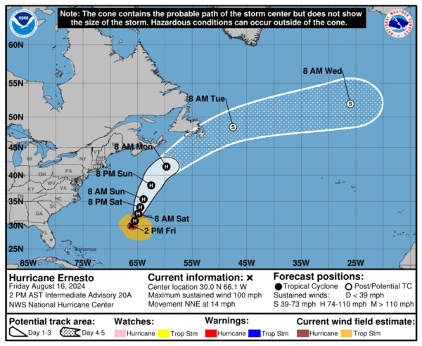
TROPICS: This afternoon Hurricane Ernesto is packing sustained winds of 100 mph, and is about 180 miles south/southwest of Bermuda. The hurricane will move near, or right over the island tomorrow morning. From there, it will head for the cooler waters of the North Atlantic.
Ernesto is no threat to the U.S… and the rest of the Atlantic basin is remarkably quiet for mid-August.
ON THIS DATE IN 1969: Hurricane Hunters gathering data on Camille in the Gulf of Mexico found a strong Category 5 hurricane on the Saffir–Simpson scale, and recorded a very low pressure of 908 mg (26.82″), with winds estimated at 175 mph. It would make landfall the following date, August 17, at Bay St. Louis, Mississippi. Camille is one of just four Category 5 hurricanes to make landfall in the U.S.
Camille caused tremendous damage in its wake and produced a peak official storm surge of 24 feet. It flattened nearly everything along the Mississippi coast and caused additional flooding and deaths inland while crossing the Appalachian Mountains of Virginia. In the U.S., Camille killed more than 259 people.
Look for my next video briefing here by 6:00 a.m. Monday… enjoy the weekend!
Category: Alabama's Weather, ALL POSTS, Weather Xtreme Videos


