Midday Nowcast: Heat, Humidity, Some Strong Storms, and a Hurricane
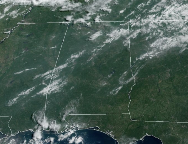
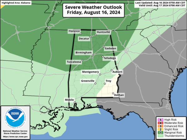
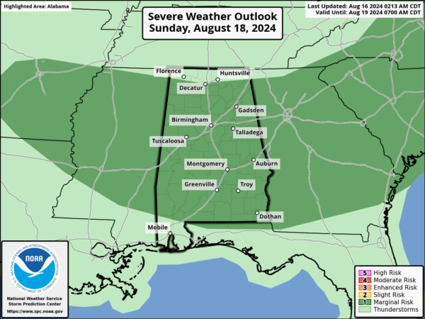
TODAY THROUGH THE WEEKEND: This afternoon and evening an approaching front will cause showers and thunderstorms to increase over the northern third of the state. It will not rain everywhere, so don’t expect widespread rain and storms. The SPC maintains a “marginal risk” of severe storms there due to the potential for strong, gusty winds.
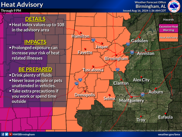
Highs today are in the low and mid 90s. We also note, with the higher humidity today, heat index values are over 105° this afternoon and we have a Heat Advisory in effect for portions of North/Central Alabama.
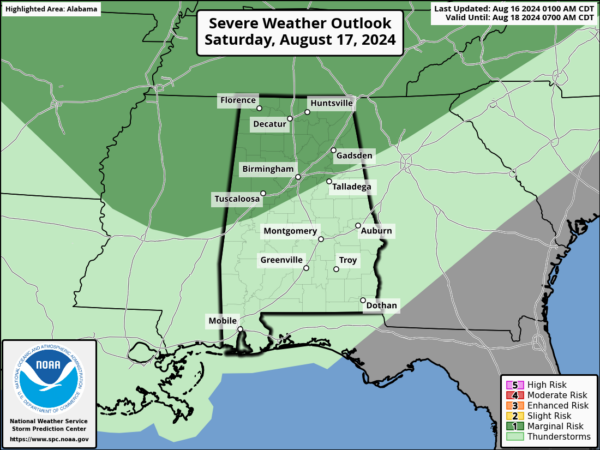
The front will sag southward tomorrow, and the SPC has a “marginal risk” for the northern third of the state again tomorrow afternoon and evening as more strong storms are expected again gusted winds are the main threat.
Of course, expect tremendous amounts of lightning with any storms which develop. Despite the higher rain chances, it still won’t rain everywhere. Highs tomorrow will again rise into the low and mid 90s.
The front slows down over the state, so we will need to continue to maintain the chance for showers and storms, and again, the SPC has a “marginal risk” for nearly the entire state. Same threat as today and tomorrow, gusty winds are the main threat, but again heavy downpours and frequent lightning. Highs will be in the low 90s.
BIRMINGHAM ALMANAC: For August 16th, the average high for Birmingham is 91° and the average low is 72°. The record high is 103° set in 2007, while the record low is 57° set in 1992. We average 0.14” of precipitation on this date, and the record value is 2.13” set in 1901.
NEXT WEEK: A very comfortable air mass for August will settle into the state for most of next week. Much lower humidity, with abundant sunshine through Wednesday. Highs will drop into the 80s, while lows fall into the 60s. Of course, some of the cooler spots could see some upper 50s. It will be dry, but a few isolated showers will be possible by the time we get to Thursday and Friday.
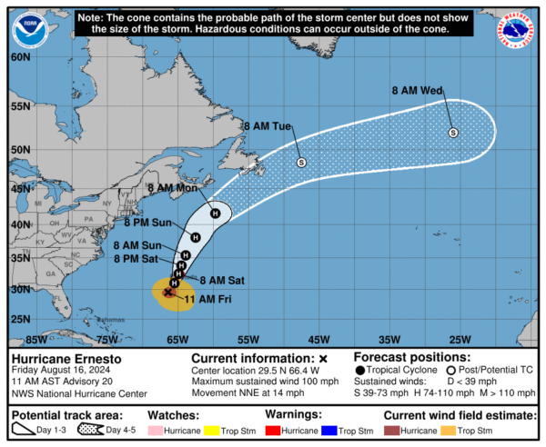
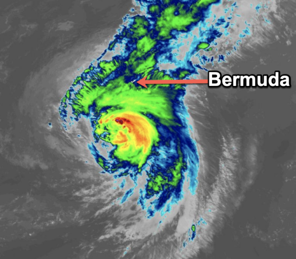
HURRICANE ERNESTO: Ernesto is moving toward the north-northeast near 14 mph. This general motion is expected to continue with a gradual slowdown by Saturday. A faster northeastward motion is expected late in the weekend. On the forecast track, the center of Ernesto is expected to pass near or over Bermuda on Saturday morning.
Maximum sustained winds are near 100 mph with higher gusts. Some gradual weakening is forecast over the next day or so, though some re-intensification is possible by early next week. Ernesto remains a large tropical cyclone. Hurricane-force winds extend outward up to 75 miles from the center, and tropical-storm-force winds extend outward up to 275 miles. The minimum central pressure based on data from an Air Force Hurricane Hunter aircraft is 970 mb (28.65 inches).
The rest of the Atlantic remains quiet for now.
WORLD TEMPERATURE EXTREMES: Over the last 24 hours, the highest observation outside the U.S. was 122.7F at Shurchi, Uzbekistan. The lowest observation was -103.9F at Vostok, Antarctica.
CONTIGUOUS TEMPERATURE EXTREMES: Over the last 24 hours, the highest observation was 112F at North Shore, CA. The lowest observation was 30F at Mackay, ID.
Category: Alabama's Weather, ALL POSTS, Tropical

