Midday Nowcast: Moderate Drought Continues, but Some Storms are on the Way
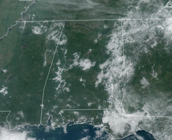
Mainly sunny and hot today with highs in the low to mid 90s. We continue to see moisture levels rise today and we will mention the risk of an isolated showers or storms during the afternoon and evening hours, but these will be few and far between. We fully expect most locations to remain dry today.
BIRMINGHAM ALMANAC: For August 15th, the average high for Birmingham is 91° and the average low is 72°. The record high is 105° set in 2007, while the record low is 56° set in 2004. We average 0.13” of precipitation on this date, and the record value is 1.66” set in 1974.
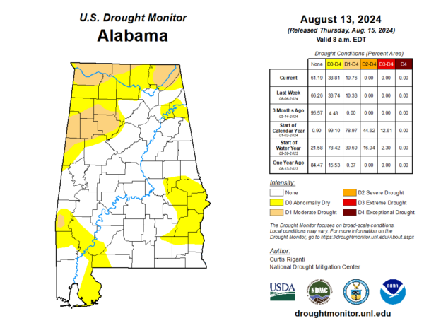
DROUGHT MONITOR: New drought monitor out today shows Moderate Drought conditions persist across West Alabama, covering portions of Walker, Fayette, Cullman, Winston, Marion, Lamar, Pickens, and Tuscaloosa Counties. In the Tennessee Valley of the state, Colbert, Lauderdale, Lawrence, Limestone, Madison, Jackson, and DeKalb Counties, have Moderate Drought, and in Southwest Alabama, portions of Choctaw County do now. All other areas in yellow are Abnormally Dry, with most of the state, in good shape as far as rainfall and drought conditions.
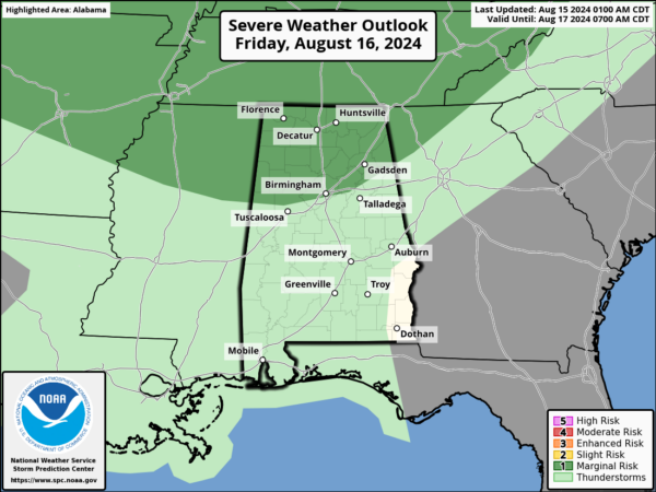
TOMORROW AND THE WEEKEND: Tomorrow afternoon and evening an approaching front will cause showers and thunderstorms to increase over the northern third of the state. The SPC has defined a “marginal risk” of severe storms there due to the potential for strong, gusty winds. Highs tomorrow will be in the low and mid 90s.
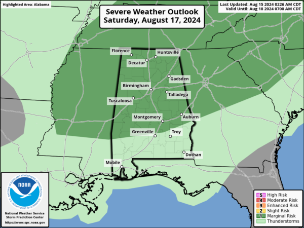
The front will sag southward Saturday, and the SPC has a “marginal risk” for most of the state for Saturday afternoon and evening as more strong storms are expected again gusted winds are the main threat. Of course, expect tremendous amounts of lightning with any storms which develop. Despite the higher rain chances, it still won’t rain everywhere. High Saturday will again rise into the low and mid 90s.
The front pushes farther south Sunday, and drier air begins to move in Sunday; any scattered showers or storms will likely be over the southern half of Alabama. Highs will be in the low 90s.
NEXT WEEK: A very comfortable air mass for August will settle into the state for most of next week. Much lower humidity, with abundant sunshine through Wednesday. Highs will drop into the 80s, while lows fall into the 60s. Of course, some of the cooler spots could see some upper 50s. It will be dry, but a few isolated showers will be possible by the time we get to Thursday and Friday.
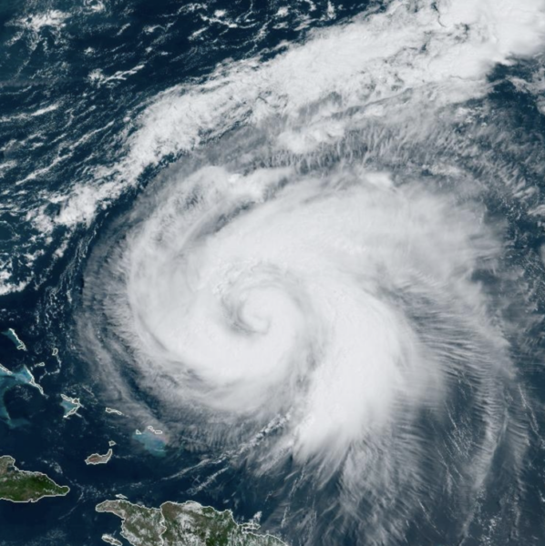
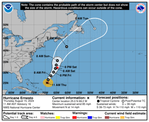
HURRICANE ERNESTO: Ernesto is moving toward the north near 14 mph. This general motion is expected to continue today, followed by a slower northeastward or north-northeastward motion on Friday and Saturday. On the forecast track, the center of Ernesto is expected to pass near or over Bermuda on Saturday.
Maximum sustained winds are near 85 mph with higher gusts. Strengthening is forecast during the next day or two, and Ernesto could be near major hurricane strength by Friday. Ernesto is forecast to be a large hurricane near Bermuda on Saturday. A Saildrone just north of the center measured sustained winds of 46 mph with a gust of 58 mph. Hurricane-force winds extend outward up to 60 miles from the center and tropical-storm-force winds extend outward up to 175 miles. The estimated minimum central pressure is 975 mb (28.80 inches).
The rest of the Atlantic remains quiet for now.
WORLD TEMPERATURE EXTREMES: Over the last 24 hours, the highest observation outside the U.S. was 119.1F at Kuwait International Airport, Kuwait. The lowest observation was -103.9F at Vostok, Antarctica.
CONTIGUOUS TEMPERATURE EXTREMES: Over the last 24 hours, the highest observation was 113F at North Shore, CA. The lowest observation was 31F at Peter Sinks, UT.
Category: Alabama's Weather, ALL POSTS

