Wednesday Late Afternoon Tropical Update: Hurricane Watch for Bermuda
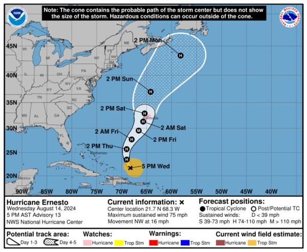
We have the latest data coming in from the National Hurricane Center as of 5pm AST. A hurricane watch is now in effect for Bermuda. A watch is typically issued 48 hours before the anticipated first occurrence of tropical-storm-force winds, conditions that make outside preparations difficult or dangerous. All residents and visitors should be paying close attention to the path of Ernesto.
Here is the latest info:
LOCATION…21.7N 68.3W
ABOUT 180 MI…290 KM E OF GRAND TURK ISLAND
ABOUT 765 MI…1230 KM SSW OF BERMUDA
MAXIMUM SUSTAINED WINDS…75 MPH…120 KM/H
PRESENT MOVEMENT…NW OR 325 DEGREES AT 16 MPH…26 KM/H
MINIMUM CENTRAL PRESSURE…989 MB…29.21 INCHES
No major changes in the forecast path. The NHC denotes a slight push to the east after 48 hours to be more in alignment with the models. There is uncertainty on just how close the center of Ernesto will be to Bermuda this weekend but impacts due seem certain enough to issue the hurricane watch.
Ernesto is in the right environment for strengthening over the next 48 hours or so and the NHC has the winds up to 115 mph by 18Z on Friday. After that, the storm moves into a more sheared, stable environment and gradual weakening should commence. They do have Ernesto as a hurricane near Bermuda.
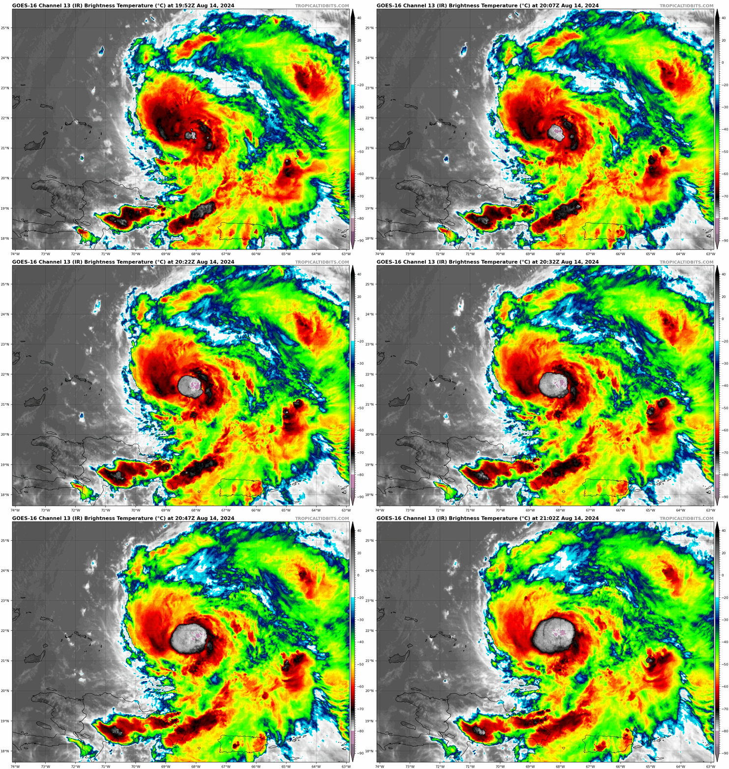
You can really see on the latest IR loop increased convection blowing up near the center of Ernesto.
At this hour, there are still some hefty rain bands over Puerto Rico. Things look better for the Virgin Islands. There has been tremendous flooding reported across Puerto Rico, along with numerous trees and power lines down.
One flooded road in #PuertoRico required some assistance to clear the way for EMS workers in the aftermath of #Ernesto ?
Credit: @MunicipioCR via Storyful pic.twitter.com/q2JrvP9Szt
— WeatherBug (@WeatherBug) August 14, 2024
Flash Flood Emergency! ??
Tropical Storm Ernesto
Jayuya, Puerto Rico
Wednesday 08/14 ? : PRInforma#Wx #Wxtwitter #Tropicswx #Puertorico pic.twitter.com/c4cXNNZvKa— Omar González_Wx ?? (@Storm_Chaser_O) August 14, 2024


