Midday Nowcast: More Clouds Today; Ernesto Now a Hurricane
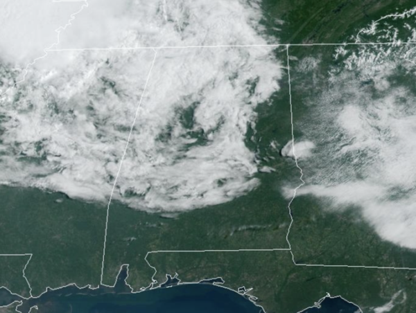
Moisture levels are beginning to rise today, we will mention the risk of a few isolated showers or storms the rest today. We are seeing more clouds in the Alabama today as well and highs today are in the low 90s. The weather won’t change much tomorrow as it will be a rinse and repeat forecast.
BIRMINGHAM ALMANAC: For August 14th, the average high for Birmingham is 91° and the average low is 72°. The record high is 104° set in 2007, while the record low is 54° set in 2004. We average 0.13” of precipitation on this date, and the record value is 2.24” set in 1939.
ACROSS THE USA: Heavy rainfall, strong winds and coastal impacts continue to affect Puerto Rico and USVI as Ernesto tracks northward. Meanwhile, frontal system was lifting northward across the center of the nation with more showers, thunderstorms and heavy rainfall. Heat concerns continue for the Southern Plains, Gulf Coast and most of Florida. Fire Weather and Air Quality concerns linger for Pacific Northwest.
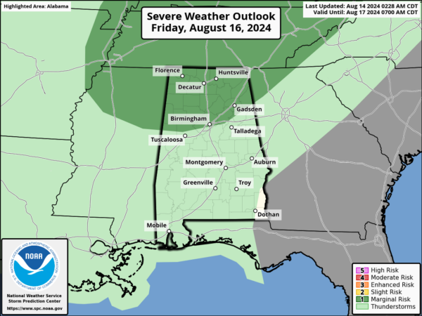
FRIDAY AND THE WEEKEND: By Friday afternoon and evening an approaching front should cause thunderstorms to increaser over the northern third of the state. The SPC has defined a “marginal risk” of severe storms there due to the potential for strong, gusty winds.
The front will sag southward Saturday, and should be the day with the highest coverage of showers and storms. Still, it won’t rain everywhere… any one spot stands a 40-50 percent chance of seeing some rain. Then, a drier airmass works into the state Sunday with a mostly sunny sky and only a small risk of a shower. Highs will be in the low 90s both days.
NEXT WEEK: Overall, the quiet weather pattern will continue across Alabama with no big ticket weather item for Alabama the next 10-14 days. In fact next week, looks very similar to this week: dry weather for Monday and Tuesday with lows in the 60s. A few showers or storms are possible over the latter half of the week and afternoon temperatures will remain near average levels with highs in the low 90s.
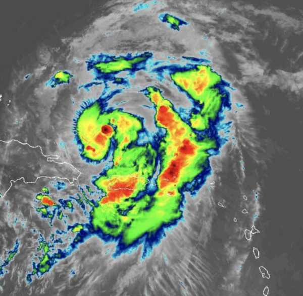
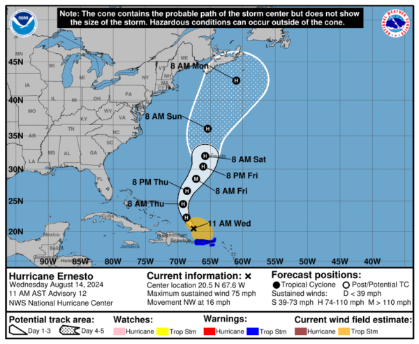
HURRICANE ERNESTO: Ernesto is now a hurricane…At 1100 AM AST, the center of Hurricane Ernesto was located near latitude 20.5 North, longitude 67.6 West. Ernesto is moving toward the northwest near 16 mph. A turn toward the north-northwest and north is expected later today and tonight, with a generally northward motion at a slower forward speed continuing through Saturday. On the forecast track, the center of Ernesto will continue to move away from Puerto Rico today, move across the western Atlantic during the next few days, and approach Bermuda Friday and Saturday.
Data from Air Force Reserve and NOAA Hurricane Hunter aircraft indicate that maximum sustained winds have increased to near 75 mph with higher gusts. Additional strengthening is forecast during the next couple of days. Hurricane-force winds extend outward up to 35 miles from the center and tropical-storm-force winds extend outward up to 230 miles. The estimated minimum central pressure is 991 mb (29.27 inches).
The rest of the Atlantic remains quiet for now.
WORLD TEMPERATURE EXTREMES: Over the last 24 hours, the highest observation outside the U.S. was 120.6F at Tabas, Iran. The lowest observation was -100.7F at Vostok, Antarctica.
CONTIGUOUS TEMPERATURE EXTREMES: Over the last 24 hours, the highest observation was 115F at Death Valley, CA. The lowest observation was 29F at Crescent, OR.
Category: Alabama's Weather, ALL POSTS, Tropical


