Midday Nowcast: Little Change in the Alabama Weather; Ernesto Gaining Strength
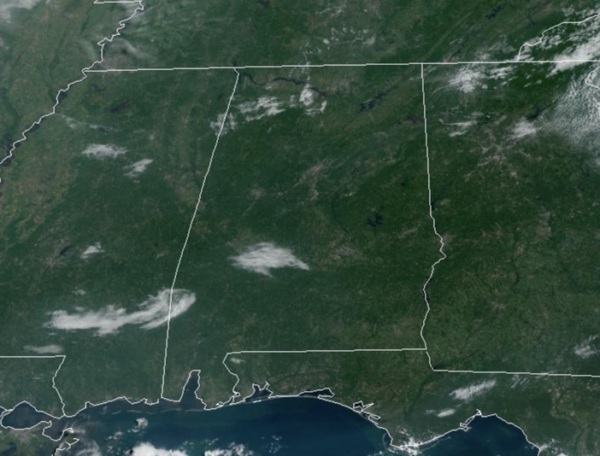
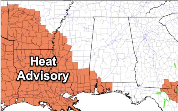
LITTLE DAY TO DAY CHANGE: Dry weather continues today, but moisture levels begin to rise on tomorrow, we will bring the risk of a few isolated showers or storms back to the forecast, mainly during the afternoon and evening hours. Highest coverage of showers will likely come on Friday with the approach of a front, but even then it certainly won’t rain everywhere. Highs will remain in the low to mid 90s.
BIRMINGHAM ALMANAC: For August 13th, the average high for Birmingham is 91° and the average low is 72°. The record high is 103° set in 2007, while the record low is 55° set in 2004. We average 0.14” of precipitation on this date, and the record value is 2.57” set in 1906.
THE ALABAMA WEEKEND: The front will dissipate as it drops south through the state, but another surge of dry air will drop into the Deep South Saturday; we will hang on to some risk of scattered showers, mainly over the southern half of the state. Sunday looks rain-free statewide and hight will hold mostly in the low 90s; humidity levels will drop again over the northern half of the state.
NEXT WEEK: Overall, the quiet weather pattern will continue across Alabama with no big ticket weather item for Alabama the next 10-14 days. In fact next week, looks very similar to this week: dry weather for Monday and Tuesday; a few showers or storms are possible over the latter half of the week. Temperatures remain near average levels with highs in the low 90s.
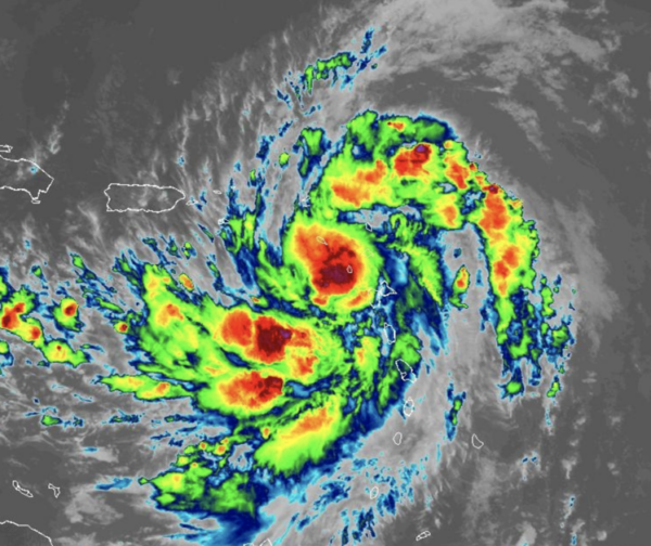
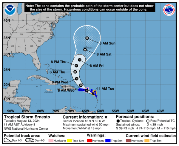
TROPICAL STORM ERNESTO: Ernesto is moving toward the west-northwest near 18 mph, and this general motion is expected to continue through tonight. A motion toward the northwest and then north at a slower forward speed is expected on Wednesday and Thursday. On the forecast track, the center of Ernesto should pass near or over the Virgin Islands this evening, and then pass just to the northeast and north of Puerto Rico tonight and on Wednesday. Ernesto should then move over the western Atlantic later in the week.
Maximum sustained winds have increased to near 50 mph with higher gusts. Additional strengthening is forecast, and Ernesto is expected to become a hurricane by early Wednesday. Tropical-storm-force winds extend outward up to 105 miles from the center. A wind gust to 65 mph was recently reported on St. Barthelemy. The estimated minimum central pressure is 1003 mb (29.62 inches).
The rest of the Atlantic Basin is quiet for now.
WORLD TEMPERATURE EXTREMES: Over the last 24 hours, the highest observation outside the U.S. was 120.7F at Kuwait International Airport, Kuwait. The lowest observation was -92.4F at Concordia, Antarctica.
CONTIGUOUS TEMPERATURE EXTREMES: Over the last 24 hours, the highest observation was 117F at Death Valley, CA. The lowest observation was 30F at Crescent, OR.
Category: Alabama's Weather, ALL POSTS


