Midday Nowcast: Hot Today, Lower Humidity this Weekend
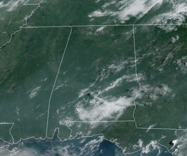
FINALLY FRIDAY: Rain chances are near zero today, but an isolated, pop-up shower or storm is always possible during the summer time in Alabama. Highs today are in the low and mid 90s across much of the state. For the weekend, the dry pattern continues as a dry, continental air mass drops in from the north, lowering our humidity levels. We expect lots of sunshine tomorrow and Sunday with highs in the mid 80s to lower 90s, while lows will slip down into the 60s, with the coolest morning being Sunday.
BIRMINGHAM ALMANAC: For August 9th, the average high for Birmingham is 91° and the average low is 72°. The record high is 103° set in 2007, while the record low is 54° set in 1976. We average 0.14” of precipitation on this date, and the record value is 2.99” set in 1970.
NEXT WEEK: Not much change in the pattern for much of next week, as Monday and Tuesday will be mainly dry days with only isolated showers and highs in the low 90s. Humidity levels begin to climb by mid-week and we will forecast a more typical summer-time forecast for Alabama: hot, humid, scattered afternoon showers and storms.
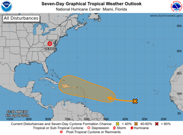
TROPICS: Debby has become post-tropical, but continues to bring flooding and severe storms to the Mid-Atlantic and Northeast today. Up next, Ernesto: A tropical wave located several hundred miles to the west-southwest of the Cabo Verde Islands is producing a large area of disorganized showers and thunderstorms over the tropical Atlantic. Any development of the wave should be slow to occur during the next couple of days while it moves westward across the central tropical Atlantic. Afterwards, conditions are expected to become more conducive for development while the wave moves west-northwestward, and a tropical depression could form by early next week while the system approaches the Lesser Antilles. The system is then forecast to continue moving generally west-northwestward and could approach the Greater Antilles by the middle part of next week. Formation chance through 7 days…medium…60 percent.
WORLD TEMPERATURE EXTREMES: Over the last 24 hours, the highest observation outside the U.S. was 119.8F at Amarah, Iraq. The lowest observation was -89.7F at Concordia, Antarctica.
CONTIGUOUS TEMPERATURE EXTREMES: Over the last 24 hours, the highest observation was 121F at Stovepipe Wells, CA. The lowest observation was 33F at Bynum, MT.
Category: Alabama's Weather, ALL POSTS


