Thursday Afternoon Tropical Update: A Tornado and Significant Flood Threat Continues with Debby; Active Hurricane Season Likely to Continue
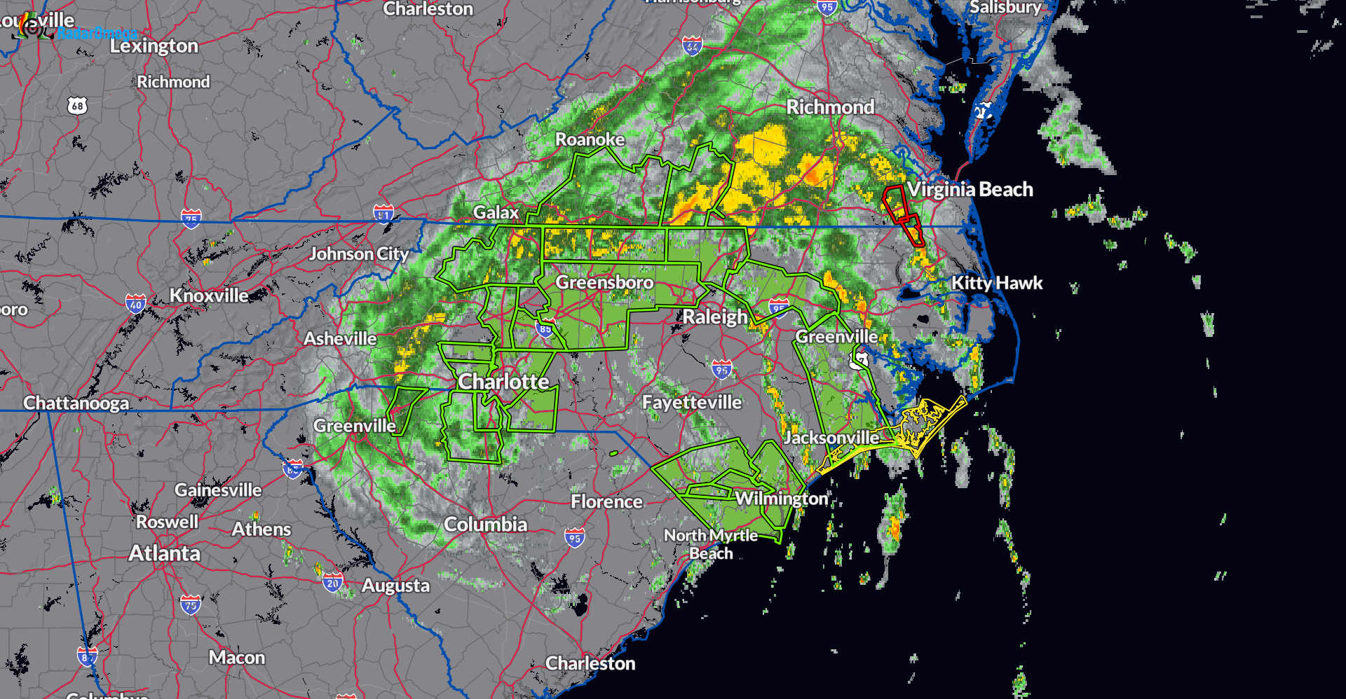
Quick update this afternoon on Debby. As of the 1pm CDT update, the center of Debby was centered about 55 miles ESE of Charlotte, NC. Max winds at 40 mph. It is moving NNE at 10 mph. An increase in forward speed is still forecast and by Saturday, Debby will be over Atlantic Canada. Along the path from the Carolinas through the Northeast, heavy rain and an isolated tornado threat will continue to be the main hazards.
In the radar snapshot above, all the green polygons indicate the current flash flood warnings. A couple of active tornado warnings (red polygons) in eastern Virginia.
Here is a look at some of the major flooding near Clarkton, NC.
Flooding and a car that didn’t make it along NC 701 outside of Clarkton, NC from TS Debby@foxweather @NWSWilmingtonNC pic.twitter.com/5jSYJMUM9s
— Mark Sudduth (@hurricanetrack) August 8, 2024
Tragically, there was a fatality confirmed from an early morning tornado in Lucama, NC.
Unfortunately one fatality has been confirmed at this home in Lucama, North Carolina after a tornado devastated the area early this morning. #Debby pic.twitter.com/1eS77XsQqA
— Bryce Shelton (@BryceShelton01) August 8, 2024
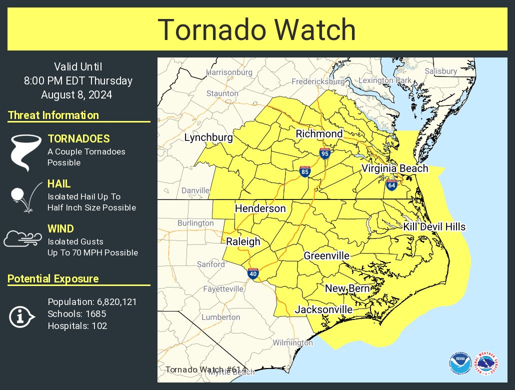
A tornado watch is in effect through 8pm EDT for portions of VA and NC from Lynchburg to Raleigh east to the coast.
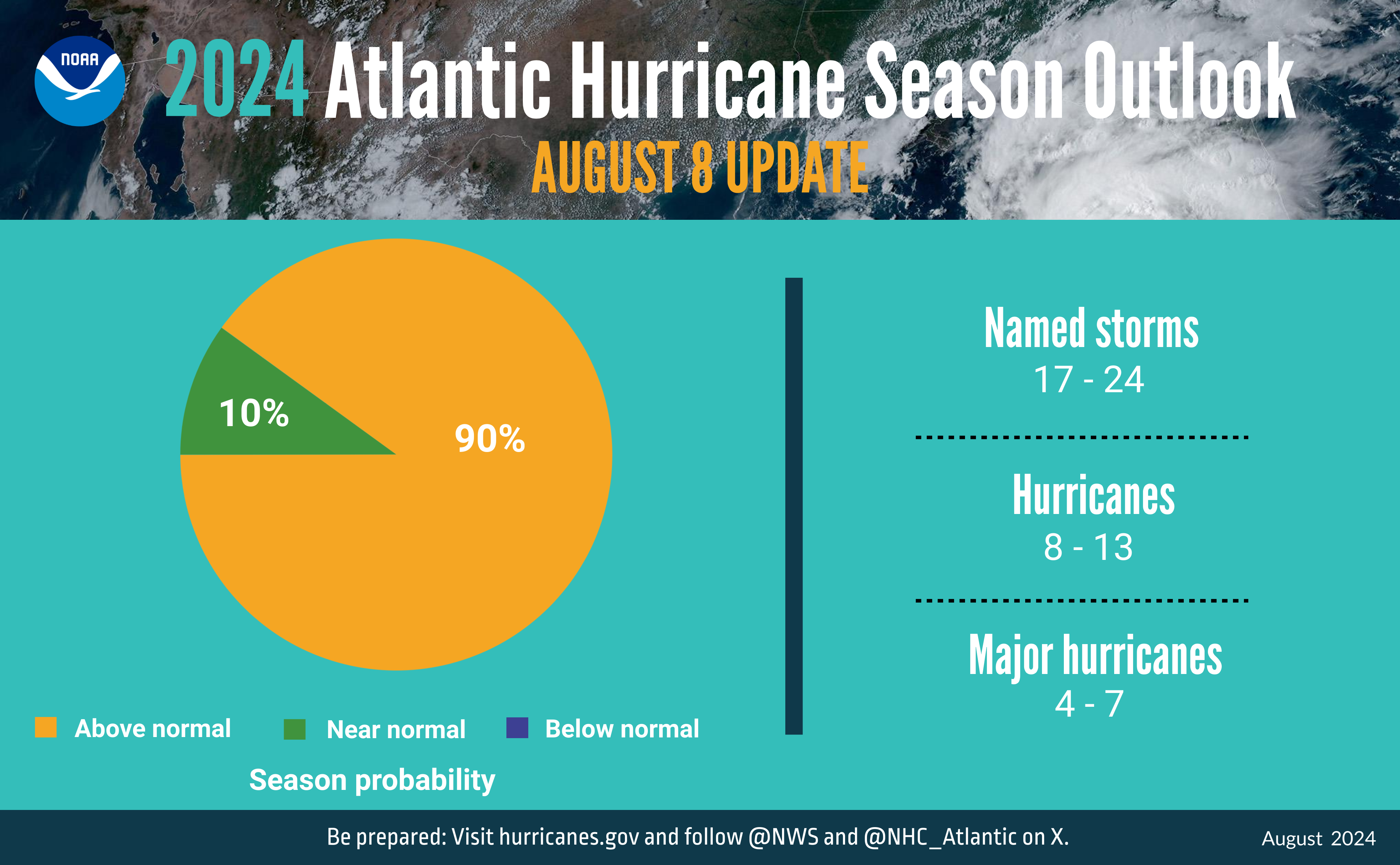
The forecasters at the Climate Prediction Center have issued their mid-season hurricane outlook. A highly active hurricane season is still projected. Near-record sea surface temperatures and the possibility of La Nina conditions are key factors to this above normal projection. Full update found here.
About the Author (Author Profile)
Owner of Tornado Talk. Radio broadcast meteorologist with The Storm Report. WeatherBrains Panelist. B.S. Meteorology from Penn State University.Subscribe
If you enjoyed this article, subscribe to receive more just like it.


