Midday Nowcast: Improvements in the Drought across Alabama
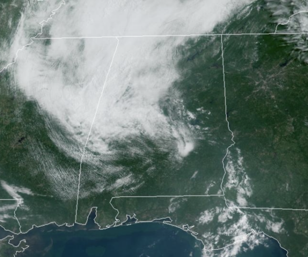
For today and tomorrow highs will be in the mid 90s across much of the state. Rain chances are near zero each day as well, but an isolated, pop-up shower or storm is always possible. The better chance of these today will be along east of Interstate 65.
BIRMINGHAM ALMANAC: For August 8th, the average high for Birmingham is 91° and the average low is 72°. The record high is 104° set in 1935, while the record low is 60° set in 1990. We average 0.14” of precipitation on this date, and the record value is 2.85” set in 1912.
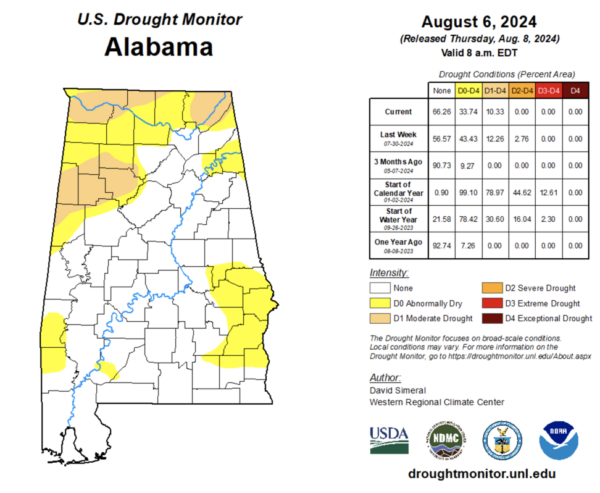
DROUGHT MONITOR: The newest drought monitor released this morning continues to show some improvement in the drought conditions across Alabama. The severe drought has been erased, and now we just have moderate drought in several areas across the state. Moderate drought continues across portions of Pickens, Lamar, Fayette, Marion, Winston, Cullman, Walker Counties as well as Colbert, Lauderdale, Madison, Lawrence, Limestone, and Jackson Counties in the Tennessee Valley. The rest of the areas in yellow are labeled as Abnormally Dry and the rest of the state is in void of drought. We will mention, with a hot and dry pattern ahead, we could see drought conditions begin to increase again across Alabama.
WEEKEND WEATHER: The dry pattern continues as a dry, continental air mass drops in from the north, lowering our humidity levels. We expect lots of sunshine Saturday and Sunday with highs in the mid 80s to lower 90s, while lows will slip down into the 60s, with the coolest morning being Sunday.
NEXT WEEK: Not much change in the pattern for much of next week, as Monday and Tuesday will be mainly dry days with only isolated showers and highs in the low 90s. Humidity levels begin to climb by mid-week and we will forecast a more typical summer-time forecast for Alabama: hot, humid, scattered afternoon showers and storms.
TROPICAL STORM DEBBY: Debby is inland over the Carolinas and is moving toward the north-northwest near 10 mph. The storm is expected to accelerate toward the north across central North Carolina through tonight. Debby is then expected to move faster toward the northeast across the U.S. Mid-Atlantic and Northeast on Friday and Atlantic Canada on Saturday.
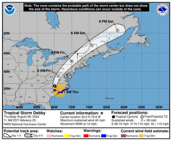
Maximum sustained winds have decreased to near 40 mph with higher gusts. Continued weakening is forecast, and Debby is likely to become a tropical depression this afternoon or evening. Debby should then merge with a front and become extratropical on Friday. The estimated minimum central pressure based on surface observations is 996 mb (29.42 inches).
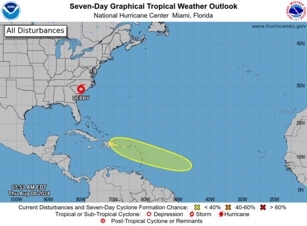
ELSEWHERE IN THE TROPICS: Most of the basin is quiet, but near the Lesser and Greater Antilles, an area of low pressure could form in the central or western tropical Atlantic Ocean early next week. Some development of this system is possible while it approaches the Lesser Antilles during the early to middle part of next week and moves generally west-northwestward toward the Greater Antilles thereafter. Formation chance through 7 days…low…30 percent.
WORLD TEMPERATURE EXTREMES: Over the last 24 hours, the highest observation outside the U.S. was 119.8F at Safi-Abad Dezful, Iran. The lowest observation was -84.1F at Vostok, Antarctica.
CONTIGUOUS TEMPERATURE EXTREMES: Over the last 24 hours, the highest observation was 119F at Death Valley and Stovepipe Wells, CA. The lowest observation was 30F at Peter Sinks, UT.
Category: Alabama's Weather, ALL POSTS
About the Author (Author Profile)
Macon, Georgia Television Chief Meteorologist, Birmingham native, and long time Contributor on AlabamaWX. Stormchaser. I did not choose Weather, it chose Me. College Football Fanatic. @Ryan_StinnetSubscribe
If you enjoyed this article, subscribe to receive more just like it.


