Debby Will Meander; Problems Increase for the Southeast Coast
Good morning! Gathered some information on the latest on Debby from The National Hurricane Center and provide some updates on what is happening now across portions of Georgia and South Carolina. Will take a quick peek into the future as well, to see how the week may unfold for those in the path of Debby!
Latest stats as of 7am CDT:
LOCATION…31.9N 81.3W
ABOUT 20 MI…35 KM SW OF SAVANNAH GEORGIA
ABOUT 105 MI…165 KM SW OF CHARLESTON SOUTH CAROLINA
MAXIMUM SUSTAINED WINDS…45 MPH…75 KM/H
PRESENT MOVEMENT…NE OR 50 DEGREES AT 6 MPH…9 KM/H
MINIMUM CENTRAL PRESSURE…999 MB…29.50 INCHES
Flash Flooding
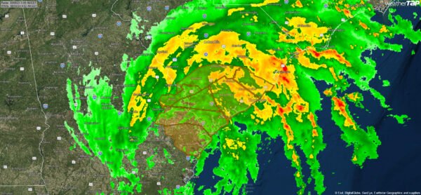
Several counties are dealing with flash flooding this morning. The areas highlighted in yellow are current flash flood warnings (as of 8am CDT). The threat for tornadoes will continue today with this rain bands pounding the southeast coast.
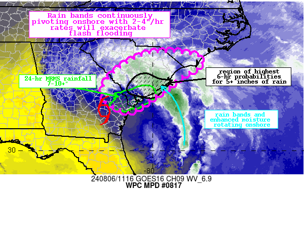
Debby has resulted in heavy rainfall and flash flooding overnight, especially across portions of the Lowcountry where 24-hr rainfall of 6-10″ has been widespread in the vicinity of I-95 between Savannah and Charleston. In their latest discussion, the Weather Prediction Center states that over the next few hours, some of the rain bands could briefly produced 4″ of rain in just an hour. 6-hour rainfall could be 3-5″ or more. Flash flooding is likely, some of which maybe significant to locally catastrophic.
Here is the latest discussion graphic, followed by a few scenes out of Charleston, SC from this morning.
latest images from downtown #charleston #chsnews #debby pic.twitter.com/dAbk0Us6FK
— Nick Reagan (@NickReaganLive5) August 6, 2024
Chaleston, SC flooding this morning from #TropicalStormDebbie @NWSCharlestonSC @jpetramala pic.twitter.com/kr2AEf4c40
— WxChasing- Brandon Clement (@bclemms) August 6, 2024
Future of Debby:
Debby is only forecast to move about 200 miles over the next 2 days ? pic.twitter.com/x2Zl83h2FD
— Ben Noll (@BenNollWeather) August 6, 2024
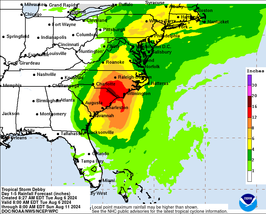
The main concern moving forward is the rain and potential for massive flooding.
The center of Debby could crawl offshore the GA coast late today and then hang out just off shore through early Thursday. That is an awful scenario as rain bands fueled with tropical moisture pull into the southeast coast and bring in the tremendous flooding.
A ridge over the western Atlantic and a trough over the upper Midwest final give Debby the push needed to move and move more quickly. A track through North Carolina and into Virginia expected by week’s end and by late Saturday night/early Sunday, the center of Debby (moving extratropical at that point) is forecast to be off the New England Coast.


