
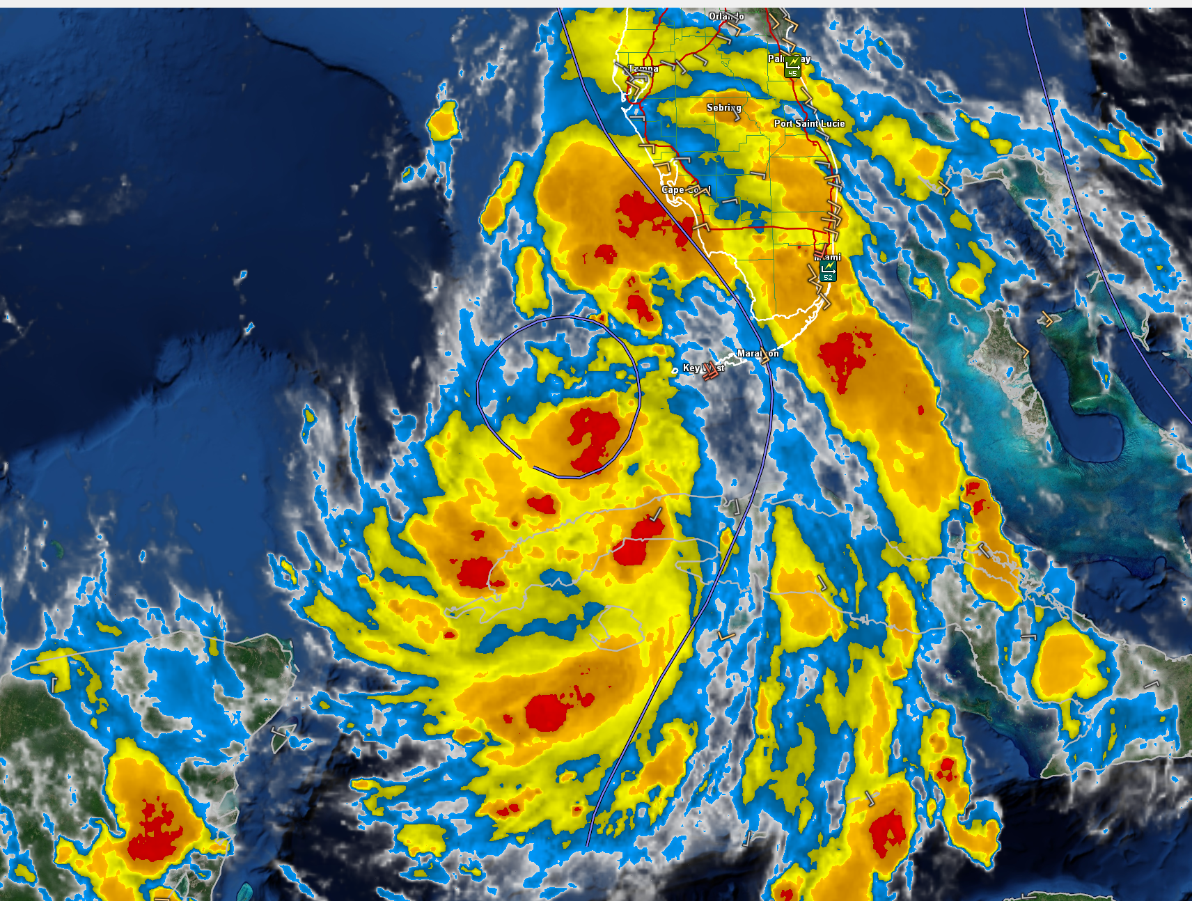
Debby 7 p.m. Advisory Talking Points
Hurricane Hunters are in the storm now. No real surprises on first pass, finding 1005 mb pressure. Winds at flight level around 40 knots, at surface 35-40 knots.
KEY DETAILS:
– Location: 24.1N 83.3W, about 100 miles WSW of Key West, Florida, and 270 miles south of Tampa, Florida.
– Maximum Sustained Winds: 40 mph (65 km/h)
– Movement: Northwest at 14 mph (22 km/h)
– Minimum Central Pressure: 1005 mb (29.68 inches)
WATCHES AND WARNINGS:
– Storm Surge Warning: In effect for the Florida coast from Aripeka northward to Indian Pass.
– Storm Surge Watch: In effect for the Florida coast from Bonita Beach northward to Aripeka, including Tampa Bay and Charlotte Harbor.
– Hurricane Warning: In effect for the Florida coast from the Suwannee River to the Ochlockonee River.
– Hurricane Watch: In effect for the Florida coast west of the Ochlockonee River to Indian Pass and east of the Suwannee River to Yankeetown.
– Tropical Storm Warning: In effect for the Florida Keys west of the Seven Mile Bridge, including the Dry Tortugas, and the Florida coast south of the Suwannee River to East Cape Sable.
– Tropical Storm Watch: In effect for the Florida Keys north of the Seven Mile Bridge to the Channel 5 Bridge and the Florida coast west of Indian Pass to Mexico Beach.
FORECAST AND HAZARDS:
– Track and Intensity: Debby is forecasted to move across the southeastern and eastern Gulf of Mexico tonight and Sunday, with a northward turn expected on Sunday and a slower northeastward motion Sunday night and Monday. The system is likely to be near hurricane strength upon reaching the Florida Gulf coast late Sunday night or early Monday.
– Wind: Hurricane conditions are expected in the hurricane warning area by late Sunday night or Monday morning, with tropical storm conditions expected on Sunday. Tropical storm conditions could spread to the Florida Panhandle by late Sunday or Monday morning.
– Storm Surge: Significant storm surge is expected, with heights reaching 4-7 feet from Yankeetown to Aucilla River, and 3-5 feet from Aripeka to Indian Pass.
– Rainfall: Heavy rainfall of 6 to 12 inches, with isolated totals up to 18 inches, is expected across portions of Florida and along the Southeast U.S. coast through Thursday, leading to considerable flash, urban, and river flooding.
– Tornadoes: A tornado or two is possible in the Florida Keys and the western Florida Peninsula tonight, expanding across much of northern and central Florida on Sunday.
– Surf: Dangerous surf and rip current conditions are expected along the Gulf coast of Florida tonight through Monday and the Southeast U.S. coast early next week due to swells generated by Debby.
SUMMARY: Tropical Storm Debby continues to organize and strengthen as it approaches the Florida coast. Preparations should be completed as conditions are expected to deteriorate rapidly, with significant storm surge, heavy rainfall, and possible tornadoes posing life-threatening risks. Residents and visitors in the affected areas should closely monitor updates and heed local officials’ instructions.
About the Author (Author Profile)
Bill Murray is the President of The Weather Factory. He is the site's official weather historian and a weekend forecaster. He also anchors the site's severe weather coverage. Bill Murray is the proud holder of National Weather Association Digital Seal #0001 @wxhistorianSubscribe
If you enjoyed this article, subscribe to receive more just like it.


