
1pm CDT Advisory on TD #4: Depression Starting to Move Into the Southeastern Gulf of Mexico.
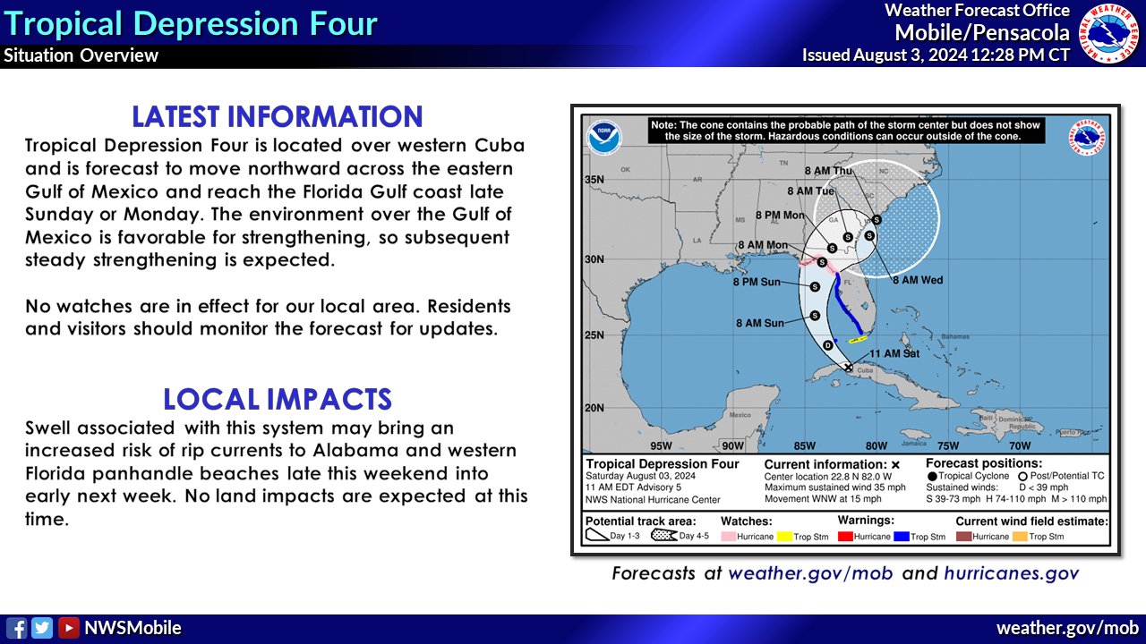
Here is the latest information on Tropical Depression #4 which is still forecast to become a tropical storm (the name would be Debby) tonight.
SUMMARY OF 200 PM EDT…1800 UTC…INFORMATION
LOCATION…23.1N 82.6W
ABOUT 15 MI…25 KM WNW OF HAVANA CUBA
ABOUT 115 MI…185 KM SSW OF KEY WEST FLORIDA
MAXIMUM SUSTAINED WINDS…35 MPH…55 KM/H
PRESENT MOVEMENT…WNW OR 300 DEGREES AT 15 MPH…24 KM/H
MINIMUM CENTRAL PRESSURE…1009 MB…29.80 INCHES
The environment this system is moving into, is highly conducive to strengthening and by the time it approaches the Florida Big Bend coast, it could be near hurricane strength.
The only watches and warnings change with this advisory is the addition of a Tropical Storm Warning for the Florida Keys from the Seven Mile Bridge westward.
Here are the updated numbers on potential storm survey:
STORM SURGE: The combination of storm surge and tide will cause
normally dry areas near the coast to be flooded by rising waters
moving inland from the shoreline. The water could reach the
following heights above ground somewhere in the indicated areas if
the peak surge occurs at the time of high tide…
Aripeka, FL to Aucilla River, FL…3-5 ft
Aucilla River, FL to Indian Pass, FL…2-4 ft
Bonita Beach, FL to Aripeka, FL…2-4 ft
Tampa Bay…2-4 ft
Charlotte Harbor…2-4 ft
There is a growing concern with the model trends that this storm will slow down as it moves across northern Florida and into South GA and near the South Carolina Coast, and we could have a meandering system bringing the potential for tremendous flooding. Some areas of western Florida into the northern parts of the state could receive over 8-12 inches of rain. Higher amounts are possible especially if this system slows to a crawl.
TORNADOES: A tornado or two is possible across the Florida Keys and the western Florida Peninsula tonight through Sunday morning.
SURF: Swells generated by the depression are expected to affect much of the Gulf coast of Florida tonight through Monday and along the Southeast U.S. coast early next week. These swells are likely to cause life-threatening surf and rip current conditions.
Category: Alabama's Weather, ALL POSTS, Tropical
About the Author (Author Profile)
Subscribe
If you enjoyed this article, subscribe to receive more just like it.


