Severe Thunderstorm Warning for parts of Shelby and Jefferson Counties until 6pm CDT
Large storm packing a punch with the potential for severe winds moving east from near Minor to Hueytown to Concord. The Birmingham metro will be in the midst of this storm for at least the next 30-45 minutes with not only the damaging winds but extremely heavy rain. This will snarl up the commute home and those heading to Friday night plans. Hunker down and wait for these storms to ease through before venturing out.
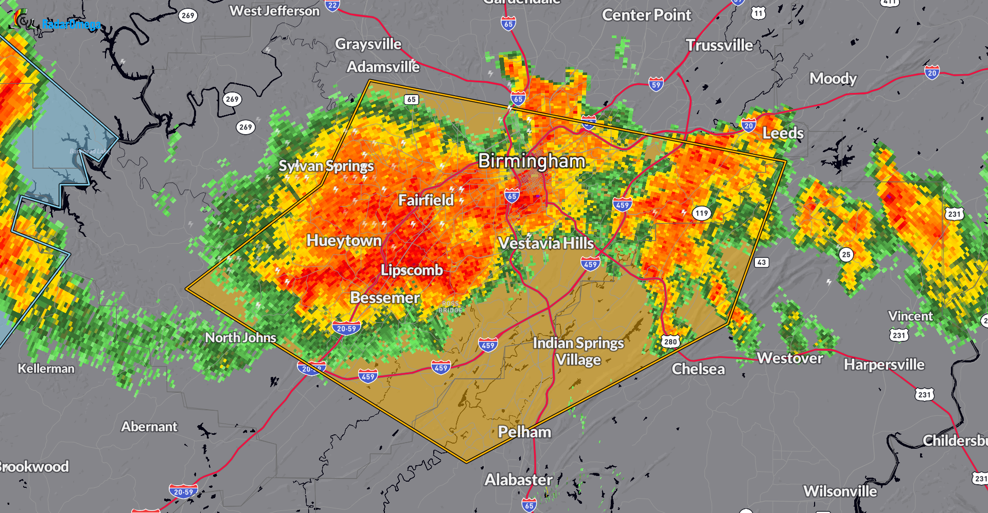
The National Weather Service in Birmingham has issued a
* Severe Thunderstorm Warning for…
Northwestern Shelby County in central Alabama…
Southern Jefferson County in central Alabama…
* Until 600 PM CDT.
* At 520 PM CDT, severe thunderstorms were located along a line
extending from Minor to Hueytown to near Concord, moving east at 30
mph.
HAZARD…60 mph wind gusts.
SOURCE…Radar indicated.
IMPACT…Expect damage to roofs, siding, and trees.
* Locations impacted include…
Birmingham, Hoover, Vestavia Hills, Bessemer, Homewood, Pelham,
Mountain Brook, Helena, Hueytown, Irondale, Leeds, Fairfield,
Chelsea, Pleasant Grove, Midfield, Adamsville, Brighton, Indian
Springs Village, Lipscomb, and Sylvan Springs.
Category: Alabama's Weather, ALL POSTS, Severe Weather
About the Author (Author Profile)
Owner of Tornado Talk. Radio broadcast meteorologist with The Storm Report. WeatherBrains Panelist. B.S. Meteorology from Penn State University.Subscribe
If you enjoyed this article, subscribe to receive more just like it.


