Severe Thunderstorm Warning for portions of Jackson and Madison Counties until 515pm CDT
There is a potent storm near New Market, moving southeast at 25 mph. 60 mph wind gusts possible and nickel size hail. Hefty rain with this too so please be weather aware.
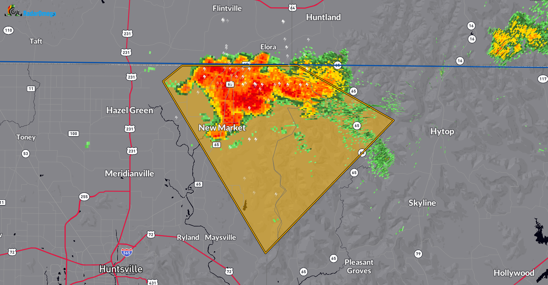
The National Weather Service in Huntsville Alabama has issued a
* Severe Thunderstorm Warning for…
Northwestern Jackson County in northeastern Alabama…
Northeastern Madison County in north central Alabama…
* Until 515 PM CDT.
* At 445 PM CDT, a severe thunderstorm was located near New Market,
or 9 miles northeast of Moores Mill, moving southeast at 25 mph.
HAZARD…60 mph wind gusts and nickel size hail.
SOURCE…Radar indicated.
IMPACT…Expect damage to roofs, siding, and trees.
* Locations impacted include…
New Market, Plevna, Larkin, and Estillfork.
Category: Alabama's Weather, ALL POSTS, Severe Weather
About the Author (Author Profile)
Owner of Tornado Talk. Radio broadcast meteorologist with The Storm Report. WeatherBrains Panelist. B.S. Meteorology from Penn State University.Subscribe
If you enjoyed this article, subscribe to receive more just like it.


