Severe Thunderstorm Warning for portions of Pickens and Lamar Counties until 515pm CDT
Numerous storms are pushing through parts of Northern and Central Alabama. As of 430pm CDT, one of the storms has become severe. It is a slow mover near the Millport area. 60 mph winds are possible and extremely heavy rain. Other storms, strong but not severe are near Haleyville, Jasper, Fayette, Tuscaloosa and in the Birmingham metro. Winds with these other storms could be from 40-50mph. Frequent cloud to ground lightning is occurring. Seek shelter from any of these storms.
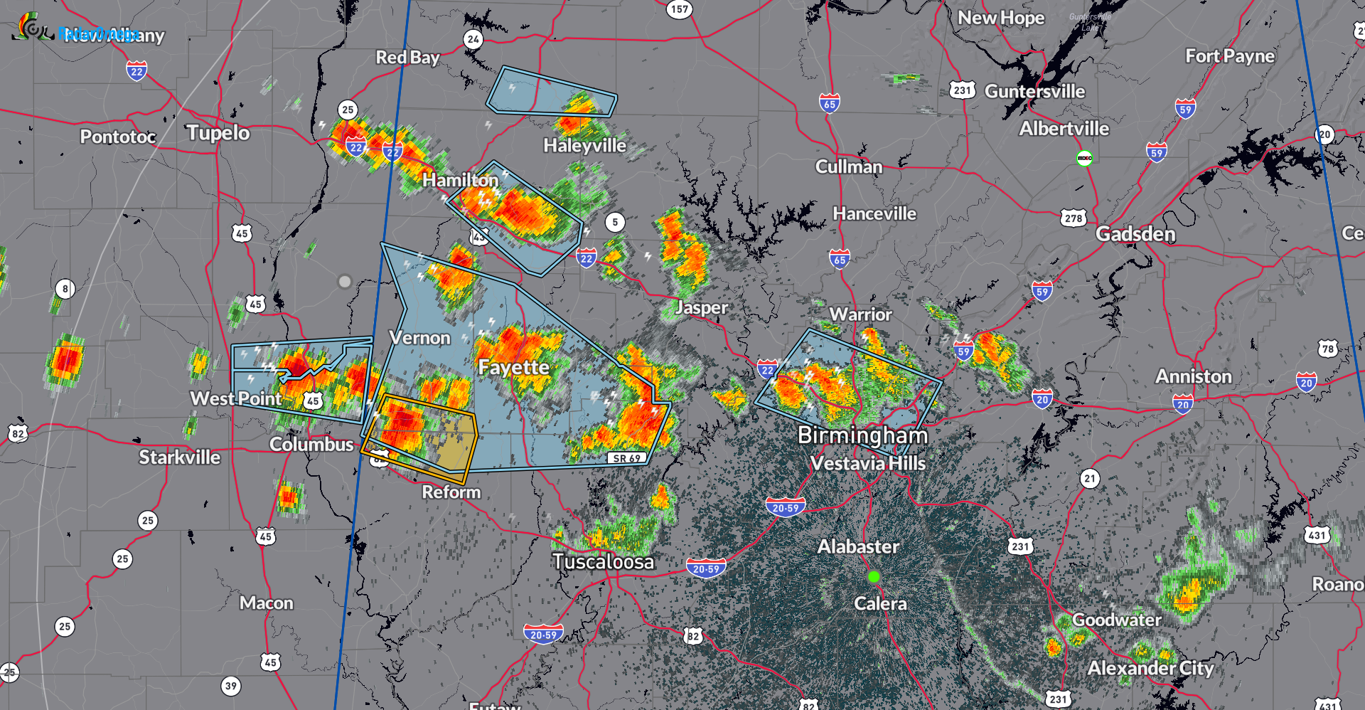
The National Weather Service in Birmingham has issued a
* Severe Thunderstorm Warning for…
North central Pickens County in west central Alabama…
Southeastern Lamar County in west central Alabama…
* Until 515 PM CDT.
* At 426 PM CDT, a severe thunderstorm was located near Millport,
moving east at 15 mph.
HAZARD…60 mph wind gusts.
SOURCE…Radar indicated.
IMPACT…Expect damage to roofs, siding, and trees.
* Locations impacted include…
Millport, Kennedy, Forest, Melborne, and Shaw.
Category: Alabama's Weather, ALL POSTS, Severe Weather
About the Author (Author Profile)
Owner of Tornado Talk. Radio broadcast meteorologist with The Storm Report. WeatherBrains Panelist. B.S. Meteorology from Penn State University.Subscribe
If you enjoyed this article, subscribe to receive more just like it.


