Severe Thunderstorm Warning for portions of Marion and Fayette Counties until 4pm CDT
A cluster of storms have started to gel in portion of northwest Alabama. This new warning is for a radar indicated severe storm over Winfield. Main threat is 60 mph wind gusts. Could be some small hail thrown in there too. Heavy rain too and frequent lightning. Storms are moving to the east at 25 mph. The environment these new storms are firing in are supportive of convective downbursts/microbursts so please be weather aware! Look for changeable weather conditions the next few hours.
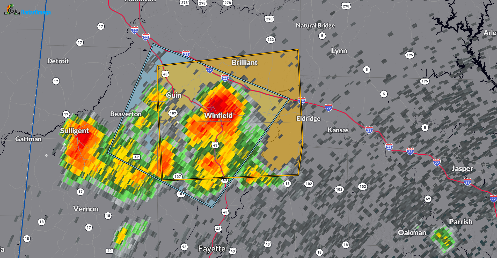
The National Weather Service in Birmingham has issued a
* Severe Thunderstorm Warning for…
Southeastern Marion County in northwestern Alabama…
Northwestern Fayette County in west central Alabama…
* Until 400 PM CDT.
* At 329 PM CDT, a severe thunderstorm was located over Winfield,
moving east at 25 mph.
HAZARD…60 mph wind gusts.
SOURCE…Radar indicated.
IMPACT…Expect damage to roofs, siding, and trees.
* Locations impacted include…
Winfield, Guin, Brilliant, Glen Allen, Gu-
Win, Bluff, Twin, Tucker, Hubbertville, Bazemore, Wayside, and
Texas.
Category: Alabama's Weather, ALL POSTS, Severe Weather
About the Author (Author Profile)
Owner of Tornado Talk. Radio broadcast meteorologist with The Storm Report. WeatherBrains Panelist. B.S. Meteorology from Penn State University.Subscribe
If you enjoyed this article, subscribe to receive more just like it.


