Midday Nowcast: Hot and Humid; Potential Tropical Cyclone Four
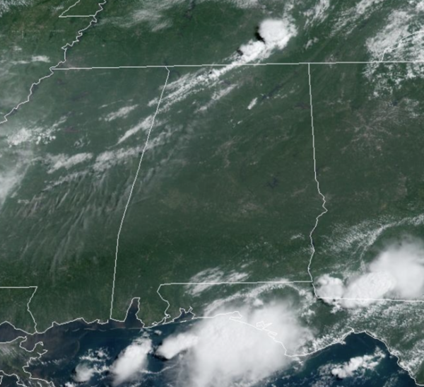
HAZY, HOT, AND HUMID: Today and through the weekend, we expect partly sunny, hot, humid days and the risk of some afternoon showers and storms. Storms will be more widely scattered in nature as the upper ridge remains in place across the Deep South. BIG HEAT, BIG STORMS and any storms which develop will pack a punch with gusty winds, frequent lightning, and torrential tropical downpours, which can lead to isolated flash flooding. Afternoon highs will range from the mid to upper 90s.
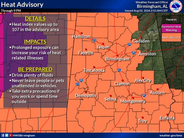
Heat Advisories remain in effect for all of Alabama today, and will likely be been extended into the weekend. Again, a heat advisory means the combination of hot temperatures and high humidity will cause heat index values to surge into the danger range, over 105°, which can quickly lead to heat illnesses.
BIRMINGHAM ALMANAC: For August 2nd, the average high for Birmingham is 91° and the average low is 72°. The record high is 101° set in 2010, while the record low is 60° set in 1992. We average 0.15” of precipitation on this date, and the record value is 4.15” set in 1941.
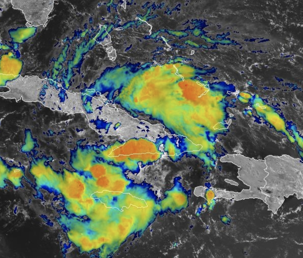
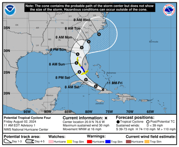
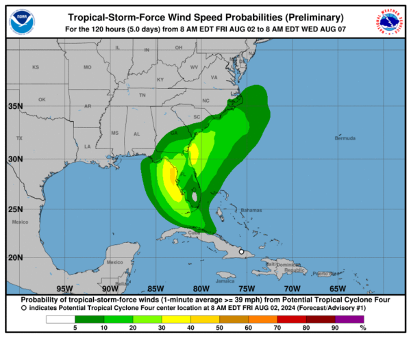
POTENTIAL TROPICAL CYCLONE FOUR: At 1100 AM EDT, the disturbance was centered near latitude 20.9 North, longitude 76.6 West. The system is moving toward the west-northwest near 16 mph. A turn toward the northwest at a slower forward speed is expected tonight or Saturday, followed by a turn toward the north on Sunday. On the forecast track, the disturbance is expected to move over Cuba today, cross the Straits of Florida on Saturday, and then move near or over the west coast of Florida Saturday night through Sunday night.
Maximum sustained winds are near 30 mph with higher gusts. The disturbance is expected to develop into a tropical depression on Saturday as it moves across the Straits of Florida, followed by intensification into a tropical storm by Saturday night. The estimated minimum central pressure is 1012 mb (29.89 inches).
WINDS: Tropical storm conditions are expected in the warning area late Saturday and Saturday night. Tropical storm conditions are possible in the watch area in the Florida Keys and the southern Florida peninsula by Saturday or Saturday night. Tropical storm conditions are possible in the watch area along the Florida west coast Saturday night or Sunday.
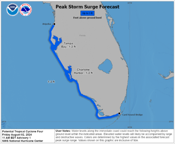
STORM SURGE: The combination of storm surge and tide will cause normally dry areas near the coast to be flooded by rising waters moving inland from the shoreline. The water could reach the following heights above ground somewhere in the indicated areas if the peak surge occurs at the time of high tide…
Aripeka, FL to Card Sound Bridge, FL…1-3 ft
Tampa Bay…1-3 ft
Charlotte Harbor…1-3 ft
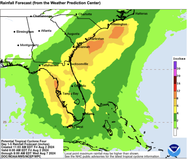
RAINFALL: Potential Tropical Cyclone Four is expected to produce rainfall totals of 4 to 8 inches, with maximum rainfall totals up to 12 inches, across portions of Florida and near the Southeast U.S. coast this weekend through Wednesday morning. This rainfall could result in areas of flash and urban flooding, with isolated river flooding possible.
NEXT WEEK: For now, typical early August weather will be the forecast for much of Alabama next week. Expect partly to mostly sunny days, with the small chance of some isolated afternoon showers and storms. Highs much of next week will be in the low to mid 90s.
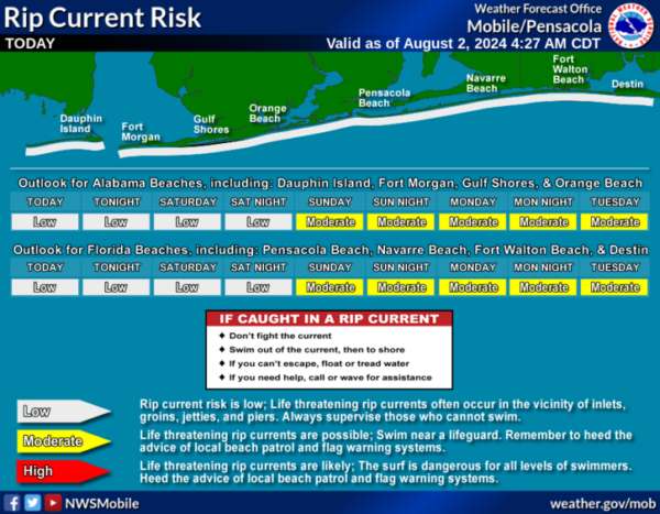
BEACH FORECAST CENTER: Scattered showers and storms each day at the beaches with highs in the mid 80s to low 90s. Water temperates remain in the mid to upper 80s. PLEASE pay attention to the Rip Current Flag System at each beach. Get the latest weather and rip current forecasts for the beaches from Fort Morgan to Panama City on our Beach Forecast Center page. There, you can select the forecast of the region that you are interested in visiting.
WORLD TEMPERATURE EXTREMES: Over the last 24 hours, the highest observation outside the U.S. was 119.3F at Amarah, Iraq. The lowest observation was -84.1F at Vostok, Antarctica.
CONTIGUOUS TEMPERATURE EXTREMES: Over the last 24 hours, the highest observation was 119F at Death Valley, CA. The lowest observation was 32F at Peter Sinks, UT.
Category: Alabama's Weather, ALL POSTS, Tropical

