Potential Tropical Cyclone Four Advisory 1
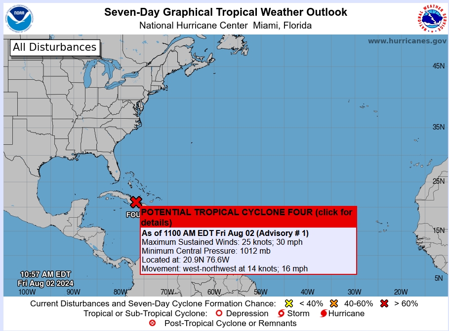
The National Hurricane Center has issued Potential Tropical Cyclone Four Advisory 1: Disturbance Located Over Eastern Cuba. Tropical Storm Warnings and Watches Issued For Portions Of Florida.
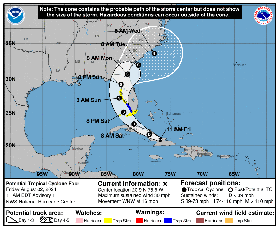
The disturbance is moving to the west-northwest around 16 mph and this will be the case for the rest of today. A turn to the northwest and a lower forward speed is forecast tonight and Saturday. A turn to the north expected on Sunday. On the forecast track, the disturbance is expected to move over Cuba today, cross the Straits of Florida on Saturday, and then move near or over the west coast of Florida Saturday night through Sunday night.
The computer models do indicated strengthening of the disturbance and we could have a tropical depression form on Saturday as it moves through the Florida Straits. Intensification to a tropical storm expected Saturday Night (the name would be Debby).
A track into north Florida then toward the southeast coast is forecast for late Sunday and into early next week. Folks along the southeast coast from Georgia to North Carolina should monitor closely the track of this system.
The biggest impacts through the weekend will be across the state of Florida. Rainfall totals of 4-8 inches possible with totals up to 12 inches. This could change depending on the speed of Potential Tropical Cyclone Four. There is a growing flooding concern.
For the west coast of Florida: The combination of storm surge and tide will cause normally dry areas near the coast to be flooded by rising waters moving inland from the shoreline. Water could reach a height of 1-3 feet for places like Tampa Bay or Charlotte Harbor especially of the peak surge occurs at the time of high tide.
Based on the latest track, the impacts on Alabama will primarily be focused at the beaches. Increased swell will lead to an increase rip current threat.
———————-
SUMMARY OF 1100 AM EDT…1500 UTC…INFORMATION
———————————————–
LOCATION…20.9N 76.6W
ABOUT 90 MI…145 KM ESE OF CAMAGUEY CUBA
ABOUT 420 MI…675 KM SE OF KEY WEST FLORIDA
MAXIMUM SUSTAINED WINDS…30 MPH…45 KM/H
PRESENT MOVEMENT…WNW OR 290 DEGREES AT 16 MPH…26 KM/H
MINIMUM CENTRAL PRESSURE…1012 MB…29.89 INCHES
WATCHES AND WARNINGS
——————–
CHANGES WITH THIS ADVISORY:
A Tropical Storm Warning is now in effect for the southwest coast
of the Florida peninsula from East Cape Sable to Bonita Beach.
A Tropical Storm Watch is now in effect for the Florida Keys south
of the Card Sound Bridge including the Dry Tortugas, the southern
coast of the Florida peninsula east of East Cape Sable to the Card
Sound bridge, and for the west coast of the Florida peninsula north
of Bonita Beach to Aripeka.
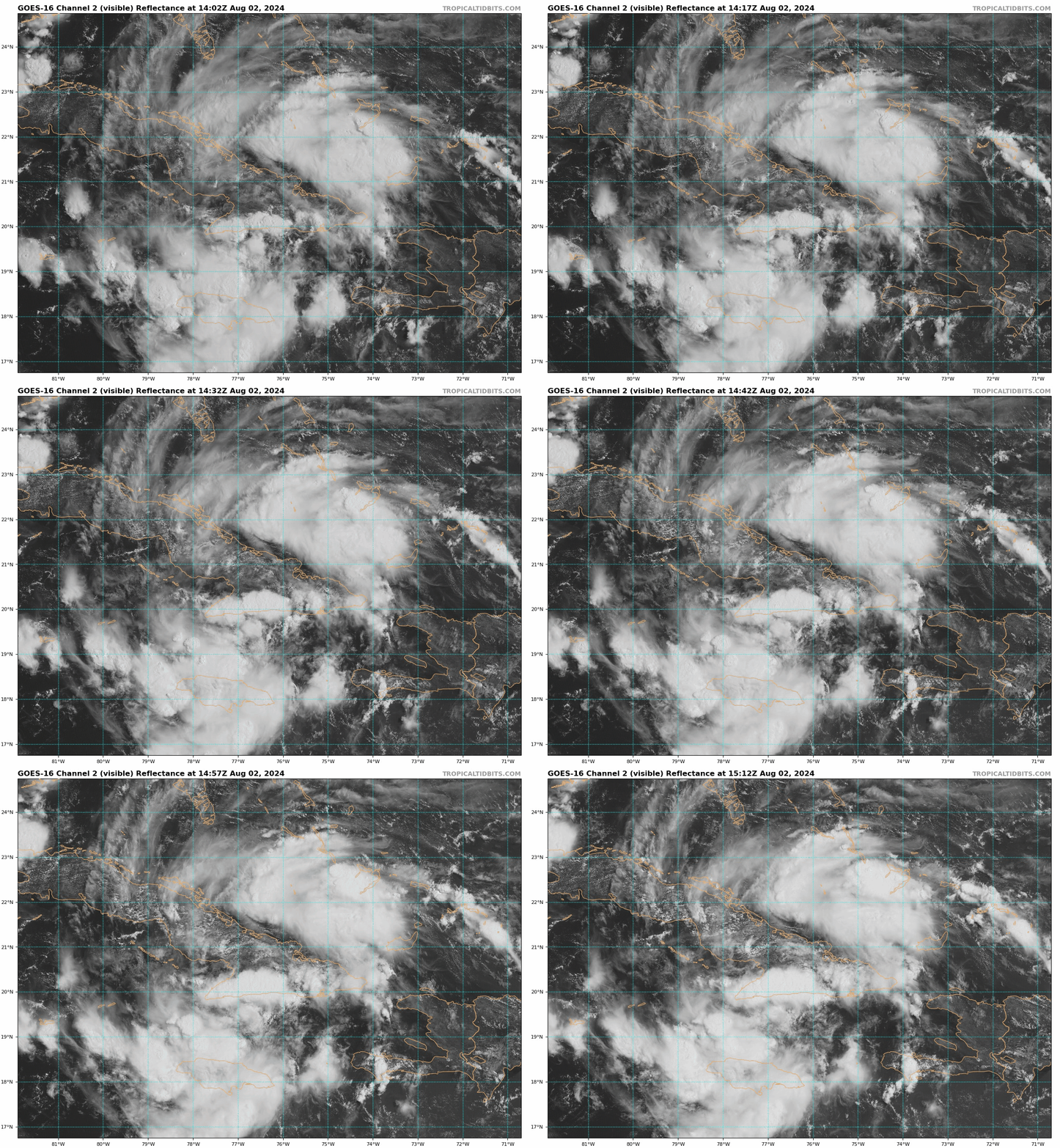
Visible Hi-Res (0.5 KM) from Tropical Tidbits
Category: Alabama's Weather, ALL POSTS, Tropical


