Midday Nowcast: Heat Advisory Continues; Some Improvements in the Drought
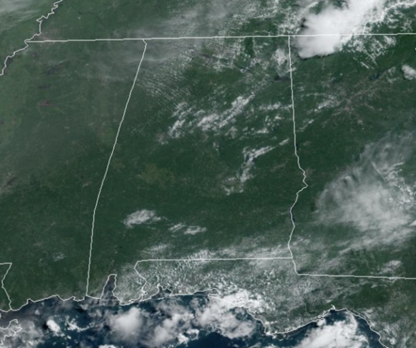
HELLO AUGUST: Little change in the forecast as we start a new month…Today, tomorrow, and through the weekend, we expect partly sunny, hot, humid days and the risk of some afternoon showers and storms. Storms will be more widely scattered in nature as the upper ridge builds remains in place across the Deep South, and again, any storms which develop will pack a punch with gusty winds, frequent lightning, and torrential tropical downpours, which can lead to isolated flash flooding. Afternoon highs will range from the mid to upper 90s.
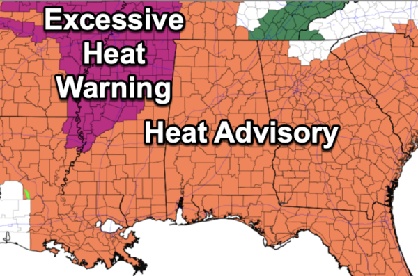
Heat Advisories remain in effect for all of Alabama today, and will likely be been extended into the weekend. Again, a heat advisory means the combination of hot temperatures and high humidity will cause heat index values to surge into the danger range, over 105°, which can quickly lead to heat illnesses.
BIRMINGHAM ALMANAC: For August 1st, the average high for Birmingham is 91° and the average low is 72°. The record high is 101° set in 2010, while the record low is 59° set in 1925. We average 0.15” of precipitation on this date, and the record value is 1.98” set in 1967.
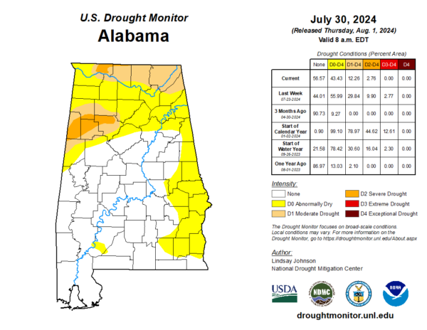
NEWEST DROUGHT MONITOR: Improving conditions across all of Alabama since last week. This week, there is no extreme drought in Alabama. We still have severe drought affecting portions Lauderdale County, but in Central Alabama it is confined to Walker, Fayette, Marion, Lamar and Pickers County. Moderate drought is impacting much of the Tennessee Valley, from Lauderdale County to DeKalb County. Moderate drought coverage Marion, Winston, Walker, Fayette, Lamar, Pickens, and Tuscaloosa Counties. Abnormally Dry conditions continue for the rest of North Alabama, will much of Central and South Alabama are drought free. Drought takes time to develop and it takes time to go away. We need a lot more rain, before we head into the drier fall months we aren’t that far away.
NEXT WEEK: For now, typical early August weather will be the forecast for much of Alabama next week. Expect partly to mostly sunny days, with the small chance of some isolated afternoon showers and storms. Highs much of next week will be in the low to mid 90s.
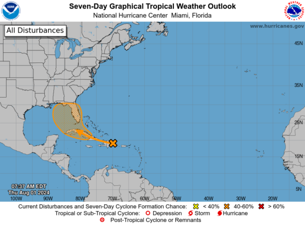
IN THE TROPICS: A well-defined tropical wave is producing a large area of disorganized showers and thunderstorms over Hispaniola, Puerto Rico, the Virgin Islands, and the adjacent waters of the southwestern Atlantic and northeastern Caribbean Sea. Development of this system should be slow to occur during the next couple of days while it moves west-northwestward over portions of the Greater Antilles. However, environmental conditions are forecast to be more conducive for development after the wave passes the Greater Antilles, and a tropical depression could form this weekend or early next week over the eastern Gulf of Mexico or near the Florida Peninsula. Interests across the Greater Antilles, the Bahamas, and Florida should continue to monitor the progress of this system. Formation chance through 7 days…medium…60 percent. Next name up is Debby.
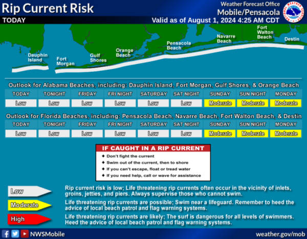
BEACH FORECAST CENTER: Scattered showers and storms each day at the beaches with highs in the mid 80s to low 90s. Water temperates remain in the mid to upper 80s. PLEASE pay attention to the Rip Current Flag System at each beach. Get the latest weather and rip current forecasts for the beaches from Fort Morgan to Panama City on our Beach Forecast Center page. There, you can select the forecast of the region that you are interested in visiting.
WORLD TEMPERATURE EXTREMES: Over the last 24 hours, the highest observation outside the U.S. was 120.0F at Omidieh, Iran. The lowest observation was -84.6F at Vostok, Antarctica.
CONTIGUOUS TEMPERATURE EXTREMES: Over the last 24 hours, the highest observation was 117F at Death Valley, CA. The lowest observation was 29F at Calpet, WY.
Category: Alabama's Weather, ALL POSTS

