Midday Nowcast: Hot and Very Humid Final Day of July
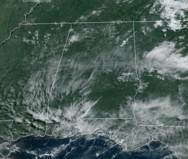
SO LONG JULY: A hot and very humid Wednesday across Alabama, with highs in the mid to upper 90s. Rain chances are around 30% with the better chance of seeing afternoon showers and storms over the eastern half of the state. We say this often this time of year, BIG HEAT MEANS BIG STORMS and any storms which develop will produce strong winds and frequent lightning, along with those tropical downpours, which can easily lead to areas of isolated flash flooding.
BIRMINGHAM ALMANAC: For July 31st, the average high for Birmingham is 91° and the average low is 72°. The record high is 101° set in 1987, while the record low is 59° set in 1965. We average 0.16” of precipitation on this date, and the record value is 4.31” set in 2012.
HELLO AUGUST: Little change in the forecast for tomorrow and through the weekend as we will continue to expect partly sunny, hot, humid days and the risk of some afternoon showers and storms. Storms will be more widely scattered in nature as the upper ridge builds across the Deep South, and again, any storms which develop will pack a punch. Afternoon highs will range from the mid to upper 90s.
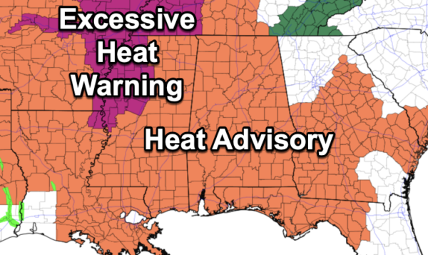
Heat Advisories remain in effect for all of Alabama today, and have been extended through tomorrow as well. Again, a heat advisory means the combination of hot temperatures and high humidity will cause heat index values to surge into the danger range, over 105°, which can quickly lead to heat illnesses. We are likely to see additional advisories issued Friday and through the weekend.
NEXT WEEK: Back to a normal summer forecast for North/Central Alabama to start off the work week as sky will be mainly sunny with only a very small chance of an isolated shower or two. Highs on Monday and Tuesday will be in the lower to mid 90s.
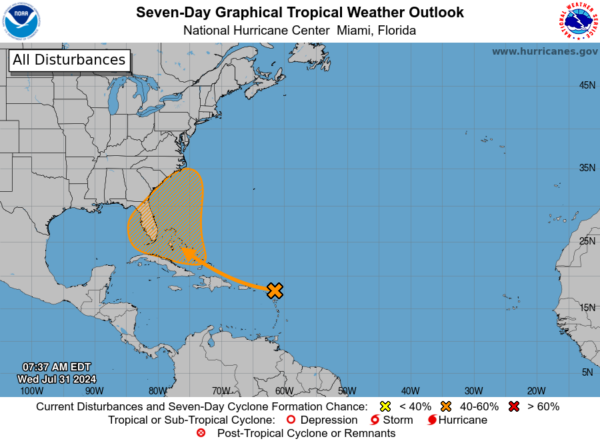
IN THE TROPICS: A large tropical wave located near the Lesser Antilles continues to produce a broad area of disorganized shower and thunderstorm activity. Environmental conditions are forecast to gradually become more conducive for development while the system moves generally west-northwestward over the Greater Antilles and towards the Bahamas. A tropical depression could form by this weekend while the system is in the vicinity of the Greater Antilles, Bahamas, or near Florida. Interests in the Greater Antilles, the Bahamas, and the southeastern U.S. should monitor the progress of this system. Formation chance through 7 days…medium…60 percent.
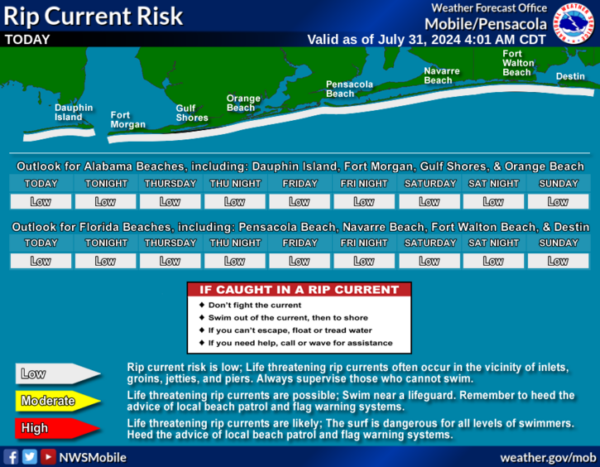
BEACH FORECAST CENTER: Scattered showers and storms each day at the beaches with highs in the mid 80s to low 90s. Water temperates remain in the mid to upper 80s. PLEASE pay attention to the Rip Current Flag System at each beach. Get the latest weather and rip current forecasts for the beaches from Fort Morgan to Panama City on our Beach Forecast Center page. There, you can select the forecast of the region that you are interested in visiting.
WORLD TEMPERATURE EXTREMES: Over the last 24 hours, the highest observation outside the U.S. was 120.9F at Al Asha, Saudi Arabia. The lowest observation was -85.9F at Concordia, Antarctica.
CONTIGUOUS TEMPERATURE EXTREMES: Over the last 24 hours, the highest observation was 114F at Rio Grande Village, TX. The lowest observation was 30F at Foxpark, WY.
Category: Alabama's Weather, ALL POSTS


