
Severe Thunderstorm Warning for Northwestern Jackson and Northeastern Madison Counties Until 430 PM CDT.
Monitoring a large area of storms moving out of southern Tennessee and into northern Alabama. They are generally moving to the southeast winds to 70 mph a possibility. Isolated larger hail potential exists as well as torrential rain. The latest warning includes Northern Huntsville, Hazel Green and Meridianville.
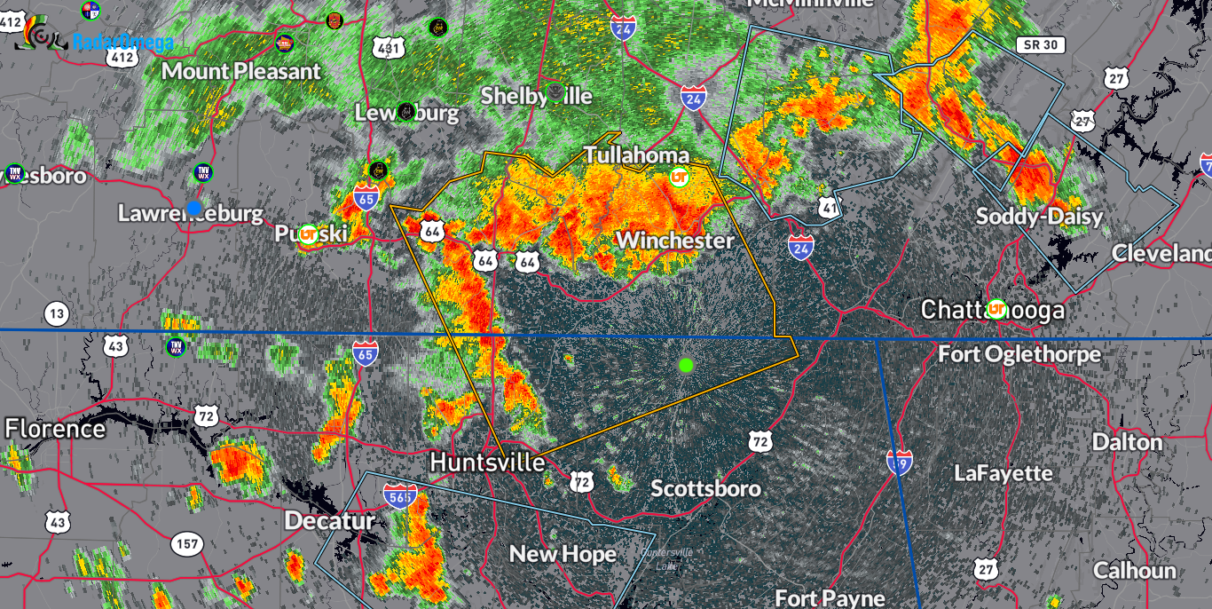
The National Weather Service in Huntsville Alabama has issued a
* Severe Thunderstorm Warning for…
Northwestern Jackson County in northeastern Alabama…
Northeastern Madison County in north central Alabama…
Moore County in Middle Tennessee…
Lincoln County in Middle Tennessee…
Franklin County in Middle Tennessee…
* Until 430 PM CDT.
* At 340 PM CDT, a severe thunderstorm was located near Lynchburg,
moving southeast at 25 mph.
HAZARD…70 mph wind gusts and quarter size hail.
SOURCE…Radar indicated.
IMPACT…Hail damage to vehicles is expected. Expect considerable
tree damage. Wind damage is also likely to mobile homes,
roofs, and outbuildings.
* Locations impacted include…
Northern Huntsville, Winchester, Fayetteville, Moores Mill,
Meridianville, Lynchburg, Hazel Green, Decherd, Estill Springs, and
Cowan.
PRECAUTIONARY/PREPAREDNESS ACTIONS…
For your protection move to an interior room on the lowest floor of a
building.
Category: Alabama's Weather, ALL POSTS, Severe Weather
About the Author (Author Profile)
Owner of Tornado Talk. Radio broadcast meteorologist with The Storm Report. WeatherBrains Panelist. B.S. Meteorology from Penn State University.Subscribe
If you enjoyed this article, subscribe to receive more just like it.


