
Scattered Storms Bubbling Up; Some Will Pack a Punch
425pm CDT: Scattered storms have formed across parts of northern and central Alabama this Monday afternoon. Not everyone getting wet, but if a storm drifts over your area, it could produce quite a bit of rain in a short amount of time, strong to isolated damaging winds and frequent lightning. A few storms coming out of southern Tennessee into far Northern Alabama have pulsed to severe limits…
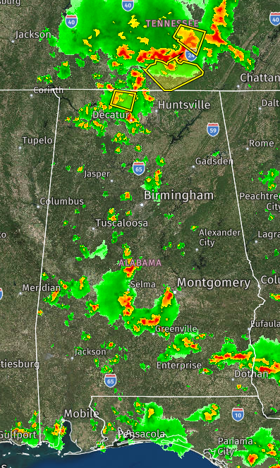
Here is the radar snapshot as of 320pm CDT.
There are a couple of areas we are monitoring for the potential of damaging winds.
The Storm Prediction Center issued a Mesoscale Discussion at 209pm CDT. Portions of southeastern Alabama through much of central and southwestern Georgia were included. No watches are expected for the rest of today but just a heads up that a few storms that form may pack a punch with strong to isolated severe wind gusts. When thunder roars….Go Indoors!
Mesoscale Discussion issued 209pm CDT:
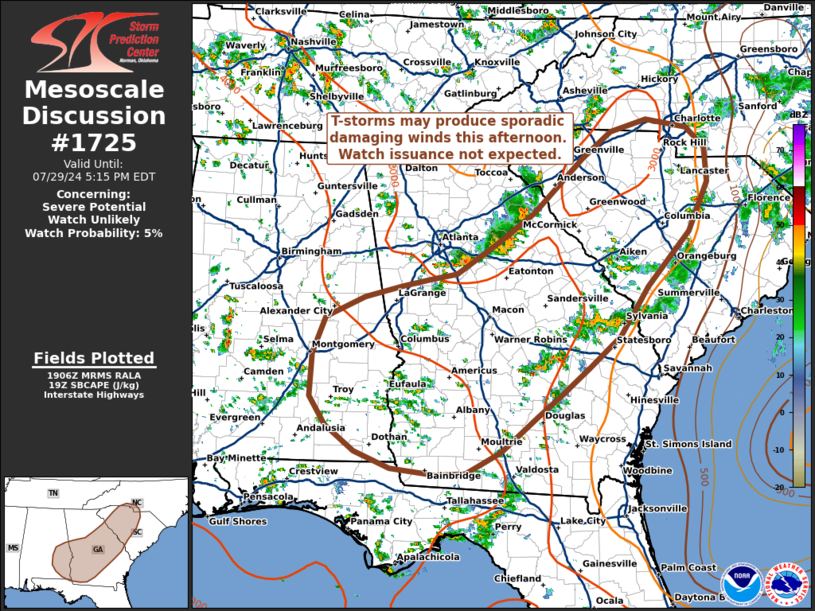
At 238pm CDT, another Mesoscale Discussion was issued, this time focused on more of northern/northeastern Alabama. From the discussion:
SUMMARY…A corridor of damaging wind potential may materialize in the next few hours across lower middle Tennessee into northeast Alabama and northwest Georgia. Watch issuance is not currently anticipated given an overall modest kinematic environment.
DISCUSSION…A cluster of poorly organized convection – driven by the remnant outflow of an early-morning MCS across the lower OH River Valley – has been percolating for much of the late morning/early afternoon hours. Over the past 30-60 minutes, regional reflectivity and velocity data has shown some tendency for consolidating outflows and the development of a more coherent cold pool to the south of the Nashville, TN area. This may be the start of a loosely organized convective line that should propagate to the southeast into parts of northeast AL and northern GA in the coming hours along a diffuse buoyancy gradient….
——————————————
For the rest of the day through tonight: The latest HRRR run keeps some sporadic storms in northern and central Alabama through midnight. A few storms linger across the southern parts of the state through the wee hours of the morning.
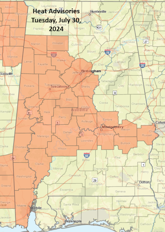
Tuesday: A wash, rinse and repeat type of scenarios with diurnally driven storms returning. Again, not everyone getting wet but where the storms fire, they could be strong. Hotter weather building in statewide on Tuesday with more counties under Heat Advisories.
Category: Alabama's Weather, ALL POSTS, Severe Weather
About the Author (Author Profile)
Owner of Tornado Talk. Radio broadcast meteorologist with The Storm Report. WeatherBrains Panelist. B.S. Meteorology from Penn State University.Subscribe
If you enjoyed this article, subscribe to receive more just like it.


