Midday Nowcast: Lower Rain Chances, Higher Heat Levels
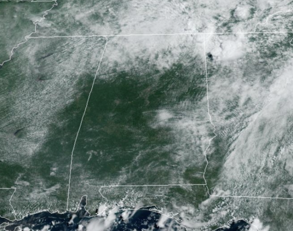
Upper 80s and low 90s today across Alabama with showers and storms developing once again as we roll into the afternoon hours. The radar will be active with storms producing lots of lightning and tropical downpours which will lead to areas of flash flooding, like we have seen the past few days across the state.
BIRMINGHAM ALMANAC: For July 29th, the average high for Birmingham is 91° and the average low is 73°. The record high is 107° set in 1930, while the record low is 60° set in 1994. We average 0.17” of precipitation on this date, and the record value is 2.16” set in 2005.
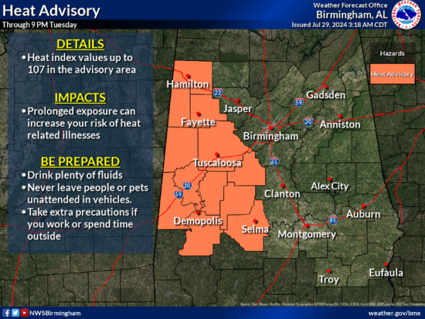
HEAT LEVELS RISING: The trend for the rest of the week will be for lower rain chances and higher heat levels as an upper ridge rebuilds over the region. Highs the rest of this week will mid 90s each day. Daily afternoon showers and storms are always possible on hot, humid summer afternoons in Alabama, but the chance of any one spot getting wet will drop into the 20-30 percent range over the latter half of the week. We also note, portions of West Alabama are already under a Heat Advisory for today and tomorrow, and we are likely to see additional advisories the rest of this week.
WEEKEND WEATHER: Not much change for the weekend; classic early August weather. Partly sunny days, the chance of a pop-up afternoon storm in spots, and highs in the low to mid 90s.
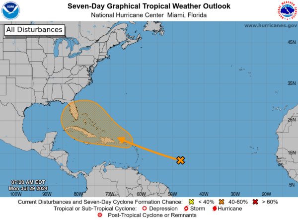
DEBBY, IS THAT YOU?: An area of unsettled weather over the central tropical Atlantic Ocean is expected to interact with an approaching tropical wave during the next couple of days. Environmental conditions are forecast to become conducive for some development thereafter, and a tropical depression could form later this week while the system is in the vicinity of the Greater Antilles or the Bahamas. Formation chance through 7 days…medium…50 percent.
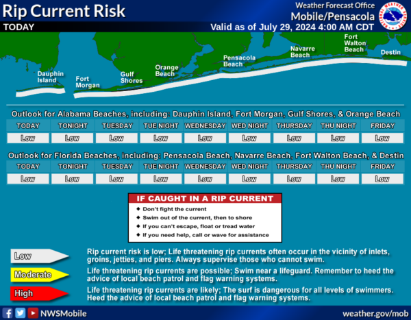
BEACH FORECAST CENTER: Scattered showers and storms at he beaches with high in the mid 80s. PLEASE pay attention to the Rip Current Flag System at each beach. Get the latest weather and rip current forecasts for the beaches from Fort Morgan to Panama City on our Beach Forecast Center page. There, you can select the forecast of the region that you are interested in visiting.
WORLD TEMPERATURE EXTREMES: Over the last 24 hours, the highest observation outside the U.S. was 121.6F at Zabol, Iran. The lowest observation was -80.3F at Dome A, Antarctica.
CONTIGUOUS TEMPERATURE EXTREMES: Over the last 24 hours, the highest observation was 114F at Death Valley, CA. The lowest observation was 31F at Bynum, MT.
Category: Alabama's Weather, ALL POSTS
About the Author (Author Profile)
Macon, Georgia Television Chief Meteorologist, Birmingham native, and long time Contributor on AlabamaWX. Stormchaser. I did not choose Weather, it chose Me. College Football Fanatic. @Ryan_StinnetSubscribe
If you enjoyed this article, subscribe to receive more just like it.


