
Flash Flood Warning for Birmingham Metro
A big, dangerous storm is moving through the Birmmingham Metro at this time. It has a tremendous amount of very dangerous lightning and torrential rains. Be in a safe place as it moves through. If you must be out, stay away from flooded areas.
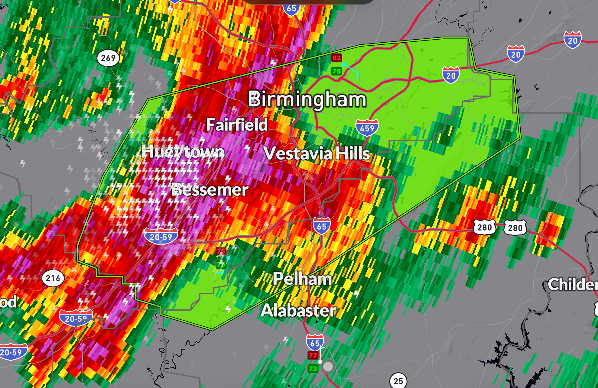
It is moving east. Storms extend back through Tuscaloosa and into Sumter, Greene, and Marengo Counties.
The National Weather Service in Birmingham has issued a
* Flash Flood Warning for…
Southeastern Jefferson County in central Alabama…
Northwestern Shelby County in central Alabama…
* Until 745 PM CDT.
* At 444 PM CDT, Doppler radar and automated rain gauges indicated
thunderstorms producing heavy rain across the warned area. Between
2 and 3 inches of rain have fallen. Additional rainfall amounts of
1 to 3 inches are possible in the warned area. Flash flooding is
ongoing or expected to begin shortly.
HAZARD…Flash flooding caused by thunderstorms.
SOURCE…Radar and automated gauges.
IMPACT…Flash flooding of small creeks and streams, urban
areas, highways, streets and underpasses as well as
other poor drainage and low-lying areas.
* Some locations that will experience flash flooding include…
Birmingham, Hoover, Vestavia Hills, Bessemer, Homewood, Pelham,
Mountain Brook, Trussville, Helena, Hueytown, Irondale, Leeds,
Moody, Fairfield, Pleasant Grove, Tarrant, Midfield, Brighton,
Indian Springs Village and Lipscomb.
Category: ALL POSTS
About the Author (Author Profile)
Bill Murray is the President of The Weather Factory. He is the site's official weather historian and a weekend forecaster. He also anchors the site's severe weather coverage. Bill Murray is the proud holder of National Weather Association Digital Seal #0001 @wxhistorianSubscribe
If you enjoyed this article, subscribe to receive more just like it.


