
Alabama Update at 3:45 p.m.
Strong storms continue across Alabama this afternoon. They are increasing slowly in intensity and coverage.
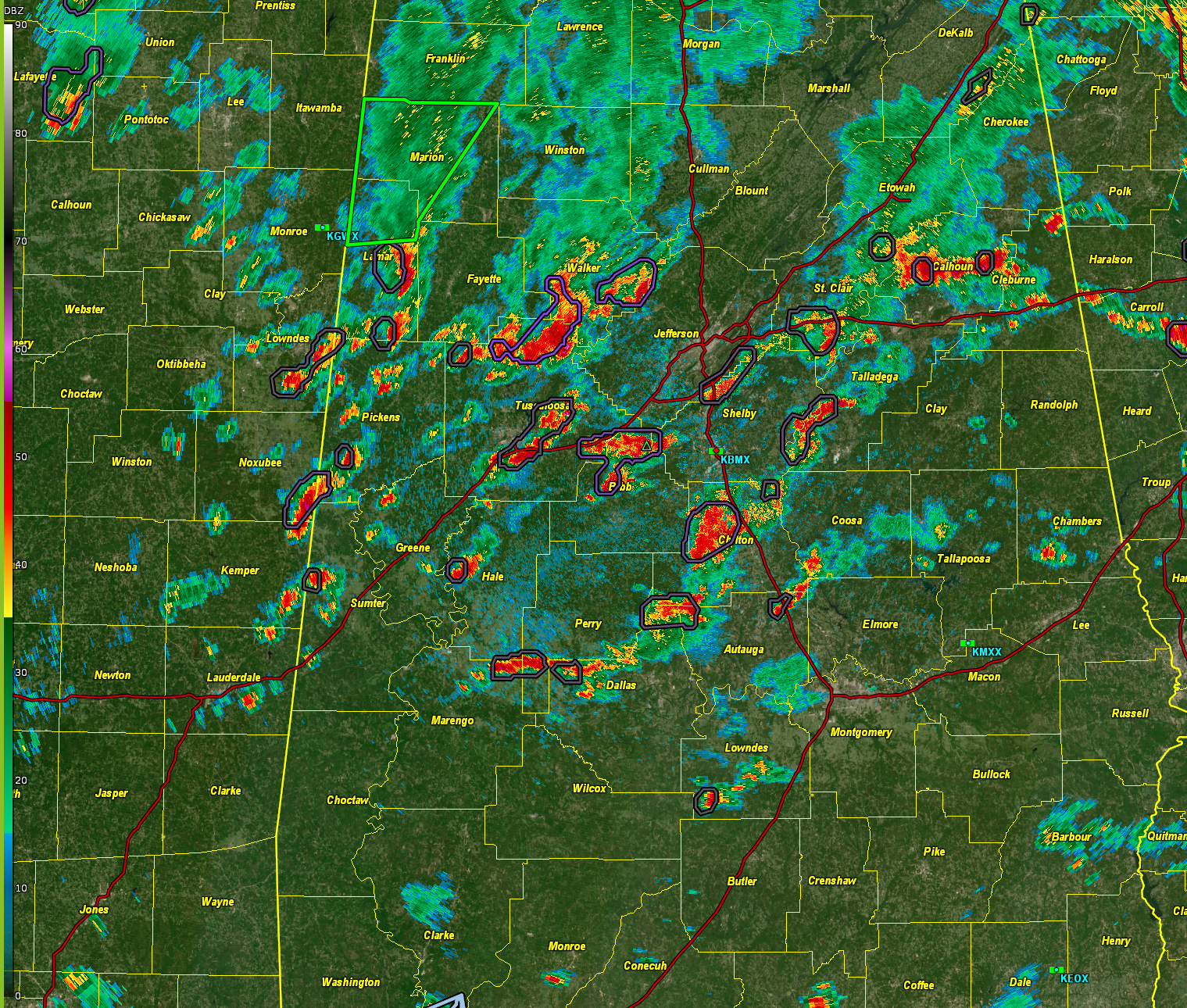
At 335 pm, the most notable storms were:
…in the Birmingham Metro, strong storms are in the I-459 Corridor from Hoover to Inverness… They extend into extreme northeastern Shelby and St. Clair. A flood advisory has been issued for these storms. Be alert to ponding on roadways and localized flooding.
…Northern Tuscaloosa/Walker: Strong storms extend from Windham Springs up Alabama 69 through Wiley…into extreme SE Fayette and into Walker around Oakman. Others extend over to Dora.
…Northern Chilton…strong storms from southwest of Jemison to Maplesville. Lots of lightning here with 29 flashes per minute.
Elsewhere, storms are scattered across Central Alabama. North Alabama is quiet for now since the atmosphere is worked over from earlier storms.
Storms will continue through the afternoon and into the evening. They should sweep southeast with time according to the convection allowing models as a trough moves by to our north.
Category: Alabama's Weather, ALL POSTS, Severe Weather
About the Author (Author Profile)
Bill Murray is the President of The Weather Factory. He is the site's official weather historian and a weekend forecaster. He also anchors the site's severe weather coverage. Bill Murray is the proud holder of National Weather Association Digital Seal #0001 @wxhistorianSubscribe
If you enjoyed this article, subscribe to receive more just like it.


