Occasional Showers/Storms Through The Weekend
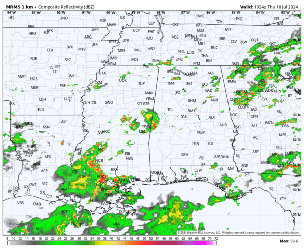
RADAR CHECK: Showers and thunderstorms continue to increase across Alabama this afternoon; heavier storms are producing strong, gusty winds and lots of lightning. The chance of showers will continue through tonight as an unstable airmass remains in place.
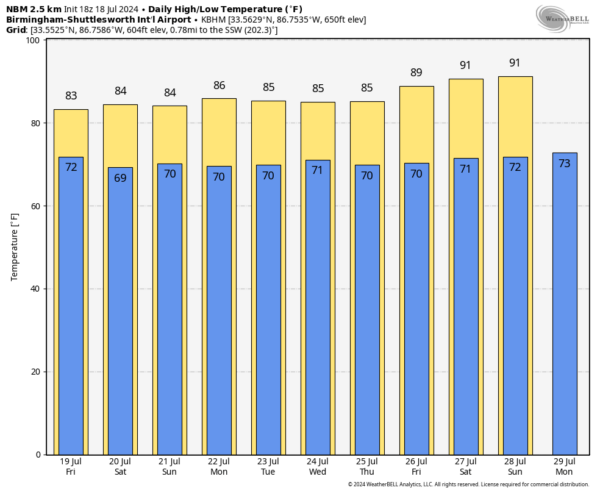
TOMORROW THROUGH THE WEEKEND: The weather will be wet at times as an unsettled pattern develops. Expect a mostly cloudy sky with occasional showers and thunderstorms tomorrow through the weekend. Not a wash-out, and the sun will be out at times, but expect rain at times. Because of the clouds and showers highs will be only in the 83-86 degree range.
The pattern won’t change next week. With an upper trough nearby, and a moist, unstable airmass in place, occasional showers and storms are likely on a daily basis through the week. Average rain amounts for Alabama over the next seven days will be in the 2-4 inch range, very beneficial for mid-summer. It is unusual for us to see this much rain without a tropical system involved. And, because of the clouds and showers, daytime temperatures will remain below average with highs in the 80s. See the video briefing for maps, graphics, and more details.
TROPICS: Another very quiet day across the Atlantic basin, and tropical storm formation is not expected at least for the next seven days. But keep in mind the peak of the season is still ahead, in August, September, and early October.
ON THIS DATE IN 1986: In the afternoon, an F2 tornado that touched down in the northern suburbs of Minneapolis became one of the most observed and photographed tornadoes ever. The detailed coverage included video from a Minnesota DOT traffic camera and a remarkable aerial video taken from a helicopter by a television camera crew
ON THIS DATE IN 1996: A massive rainstorm in north central and northeast Illinois led to widespread flooding. Aurora reported 16.94 inches of rain, establishing a state record for the most rain in a single day. Other heavy totals included 13.60 inches at Joliet, 9.24 inches in Wheaton, 8.09 inches in DeKalb, and 7.82 inches at Elgin. This event is often called “the second most damaging weather disaster in Illinois History.”
Look for the next video briefing here by 6:00 a.m. tomorrow…
Category: Alabama's Weather, ALL POSTS, Weather Xtreme Videos


