
Midday Nowcast: Extreme Drought, but Higher Rain Chances
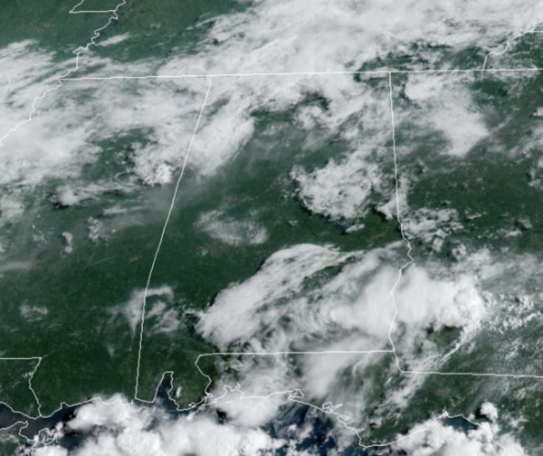
TODAY AND TOMORROW: Expect numerous showers and storms these two days, with highs in the upper 80s and low 90s today, dropping into the mid 80s tomorrow due to the clouds and rain. As always in summer, rain distribution will be very uneven, feast or famine, meaning some locations could get too much, while other spots get nothing. Of course all summertime storms produce tremendous amounts of lightning and gusty winds, along with those tropical downpours which can lead to areas of isolated flash flooding. Additionally, a few storms could become briefly severe with damaging wind gusts and wet microburst the main threats.
BIRMINGHAM ALMANAC: For July 18th, the average high for Birmingham is 91° and the average low is 72°. The record high is 99° set in 1995, while the record low is 60° set in 1967. We average 0.18” of precipitation on this date, and the record value is 1.56” set in 1901.
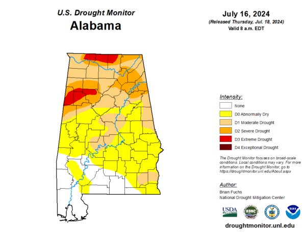
DROUGHT MONITOR: The latest drought monitor released this morning shows drought conditions only getting worse for portions of Alabama. The drought monitor is analyzed on Tuesdays and released on Thursdays, so the rain totals the last two days across the state are not included in the current analysis. This week, all of the northern third of Alabama is suffering from at least moderate drought, with severe drought now covering large portions of the area. Severe drought is now affecting portions of Etowah, Calhoun, Blount, Cleburne, Cherokee, Marshall, Winston, Walker, Cullman, Pickens, Marion, Lamar, Tuscaloosa, Lamar, and Fayette counties as well as counties in the Tennessee Valley. The level three extreme drought is now affecting portions of Pickens, Lamar, Fayette, Marion, and Walker counties as well as Lauderdale, Limestone, and Madison counties. With the higher rain chances in the forecast, hopefully we will see improvements over the next week. It takes a while for drought conditions to develop and takes a while for drought conditions to diminish.
WEEKEND WEATHER: The weather stays unsettled with a good chance of occasional showers and thunderstorms Saturday and Sunday. The weekend won’t be a wash-out by any means, but rain is likely at times with highs only in the mid 80s. Again, rainfall distribution will remain very uneven across the state.
NEXT WEEK: The pattern won’t change next week. With an upper trough nearby, and a moist, unstable airmass in place, occasional showers and storms are likely on a daily basis through the week. Average rain amounts for Alabama over the next seven days will be in the 2-4 inch range, very beneficial for mid-summer. It is unusual for us to see this much rain without a tropical system involved. And, because of the clouds and showers, daytime temperatures will remain below average with highs in the 80s.
IN THE TROPICS: The Atlantic Basin is quiet and tropical cyclone development is not expected the next seven days.
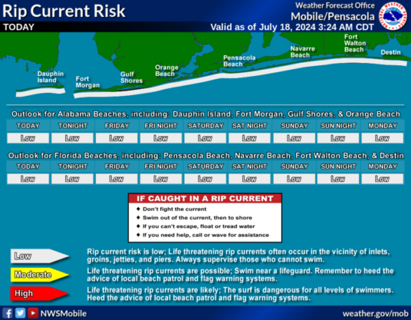
BEACH FORECAST CENTER: Highs in the upper 90s and low 90s along the beaches. Expect storms on a daily basis and water temperatures are in the mid to upper 80s up and down the Northern Gulf Coast. PLEASE pay attention to the Rip Current Flag System at each beach. Get the latest weather and rip current forecasts for the beaches from Fort Morgan to Panama City on our Beach Forecast Center page. There, you can select the forecast of the region that you are interested in visiting.
WORLD TEMPERATURE EXTREMES: Over the last 24 hours, the highest observation outside the U.S. was 120.9F at Omidieh, Iran. The lowest observation was -92.0F at Vostok, Antarctica.
CONTIGUOUS TEMPERATURE EXTREMES: Over the last 24 hours, the highest observation was 121F at Death Valley, CA. The lowest observation was 36F at Peter Sinks, UT.
Category: Alabama's Weather, ALL POSTS
About the Author (Author Profile)
Macon, Georgia Television Chief Meteorologist, Birmingham native, and long time Contributor on AlabamaWX. Stormchaser. I did not choose Weather, it chose Me. College Football Fanatic. @Ryan_StinnetSubscribe
If you enjoyed this article, subscribe to receive more just like it.


