
Midday Nowcast: Higher Rain Chances
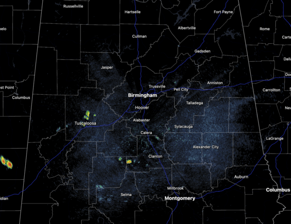
Showers and storms will begin to increase in coverage through the rest of today as the air becomes more unstable, highs today are in the low to mid 90s.
Tomorrow and Friday, we expect numerous showers and storms and with the clouds and rain, highs these two days will be in the mid and upper 80s. As always in summer, rain distribution will be very uneven, feast or famine, meaning some locations could get too much, while other spots get little to nothing. Of course all summertime storms produce tremendous amounts of lightning and gusty winds, along with those tropical downpours which can lead to areas of isolated flash flooding. Additionally, a few storms could become briefly severe with damaging wind gusts from wet microbursts the main threats.
BIRMINGHAM ALMANAC: For July 17th, the average high for Birmingham is 91° and the average low is 72°. The record high is 105° set in 1980, while the record low is 60° set in 2014. We average 0.19” of precipitation on this date, and the record value is 1.74” set in 1916.
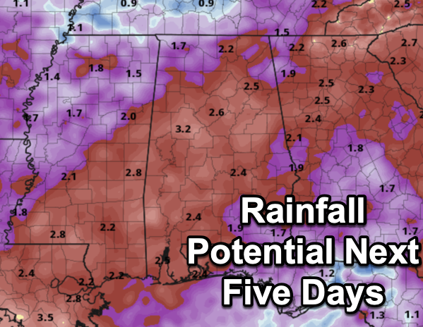
WEEKEND AND NEXT WEEK: The weather stays unsettled with a good chance of occasional showers and thunderstorms Saturday and Sunday. The weekend won’t be a wash-out by any means, but rain is likely at times with highs only in the mid 80s. Again, rainfall distribution will remain very uneven across the state. Rainfall potential through the weekend for much of the state will be in the 2-3 inch range.
This pattern will continue into next week and typical late July weather will be the story. No signs of excessive heat returning to Alabama the rest of July.
IN THE TROPICS: The Atlantic Basin is quiet and tropical cyclone development is not expected the next seven days.

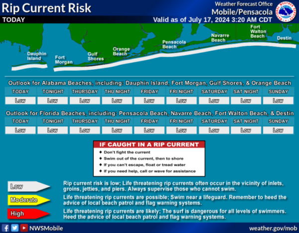
BEACH FORECAST CENTER: Highs in the upper 90s and low 90s along the beaches. Expect storms on a daily basis and water temperatures are in the mid to upper 80s up and down the Northern Gulf Coast. PLEASE pay attention to the Rip Current Flag System at each beach. Get the latest weather and rip current forecasts for the beaches from Fort Morgan to Panama City on our Beach Forecast Center page. There, you can select the forecast of the region that you are interested in visiting.
WORLD TEMPERATURE EXTREMES: Over the last 24 hours, the highest observation outside the U.S. was 120.4F at Omidieh, Iran. The lowest observation was -90.8F at Amundsen-Scott South Pole Station, Antarctica.
CONTIGUOUS TEMPERATURE EXTREMES: Over the last 24 hours, the highest observation was 120F at Death Valley, CA. The lowest observation was 33F at Mackay, ID.
Category: Alabama's Weather, ALL POSTS
About the Author (Author Profile)
Macon, Georgia Television Chief Meteorologist, Birmingham native, and long time Contributor on AlabamaWX. Stormchaser. I did not choose Weather, it chose Me. College Football Fanatic. @Ryan_StinnetSubscribe
If you enjoyed this article, subscribe to receive more just like it.


