Sizzling Weekend Ahead; Mostly Dry
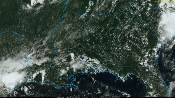
HOT SUMMER DAY: The sky is mostly sunny across Alabama this afternoon with temperatures in the 90s. Thankfully humidity values are still relatively low, so “heat index” is no factor. Tonight will be mostly fair with a low in the 70s.
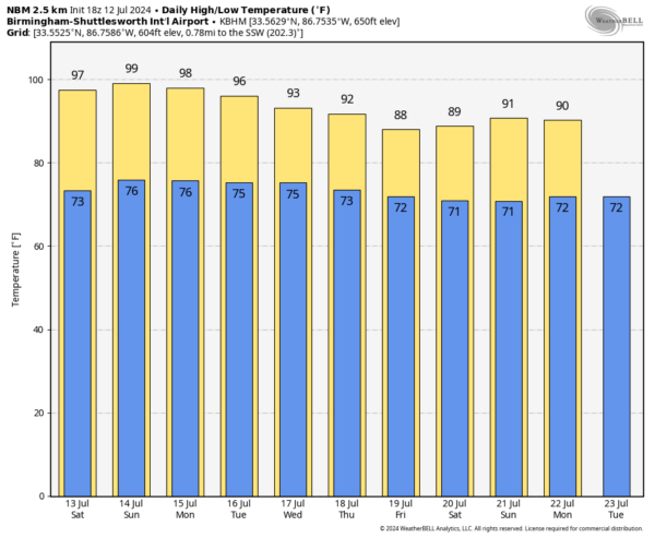
THE WEEKEND: Dry weather continues across Alabama tomorrow with a good supply of sunshine… the high today will be in the upper 90s. Thankfully humidity levels will remain fairly low helping to make the heat a little more bearable. We will introduce the chance of isolated showers Sunday, but the chance of any one spot seeing rain is only 10-20 percent. And, the weather stays hot with a high in the upper 90s Sunday afternoon.
NEXT WEEK: Not much change Monday and Tuesday. Mostly sunny, hot days with only isolated showers… highs in the mid to upper 90s. Then, we expect to see an increase in the number of scattered showers and storms over the latter half of the week as the air becomes more unstable. Still, we can’t promise rain for everyone, but the chance of your front yard getting wet rises to 60-70 percent by Thursday and Friday. Heat levels also come down with highs in the upper 80s over parts of North Alabama by the end of the week. See the video briefing for maps, graphics, and more details.
TROPICS: A broad area of low pressure centered near the South and North Carolina coastline continues to produce disorganized showers and thunderstorms. Strong upper-level winds should limit any development of this system before it moves fully inland this afternoon. However, the disturbance could contribute to areas of heavy rainfall and possible flash flooding across coastal portions of the Carolinas and Mid-Atlantic through tonight. Chance of development has dropped to 0%. The rest of the Atlantic basin is very quiet.
ON THIS DATE IN 1930: A strong upper high brought an intense heat wave to the Deep South in July 1930. Birmingham’s high on July 12 was 106 degrees… the high on July 29 was 107.
ON THIS DATE IN 1996: Hurricane Bertha makes landfall near Wrightsville Beach, NC with maximum winds of 105 mph, but the storm surge dealt the most devastation. The U.S. Virgin Islands, along with North Carolina, were declared federal disaster areas. Surveys indicate that Bertha damaged almost 2,500 homes on St. Thomas and St. John.
Look for my next video briefing here by 6:00 a.m. Monday… enjoy the weekend!
Category: Alabama's Weather, ALL POSTS, Weather Xtreme Videos


