Hot, Mostly Dry Weather Through The Weekend
DRY SUMMER DAY: The sky is mostly sunny across Alabama this afternoon with temperatures mostly in the 88-93 degree range. Tonight will be clear with a low in the upper 60s and low 70s.
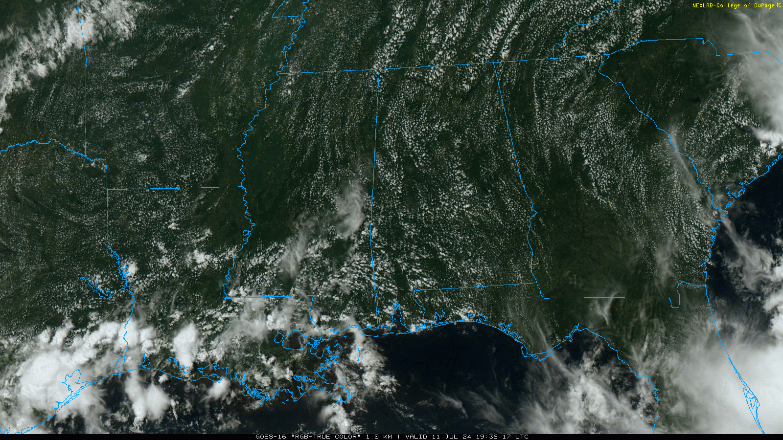
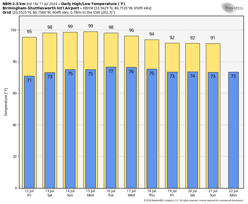
Alabama’s forecast tomorrow and through the weekend will feature gradually rising heat levels and the lack of afternoon showers and storms. Most communities will be dry through Sunday with mostly sunny days and fair nights… the high tomorrow will be mid 90s, followed by upper 90s over the weekend. Thankfully humidity levels will be relatively low for mid-summer and the heat index won’t be much of a factor. No rain through Saturday, and only isolated showers around Sunday.
NEXT WEEK: The overall pattern won’t change much for at least the first half of the week. Highs in the mid to upper 90s with only isolated showers around. There is evidence the air will be more unstable toward the end of the week with scattered showers and storms becoming more numerous by Friday and the following weekend (July 20-21)…. See the video briefing for maps, graphics, and more details.
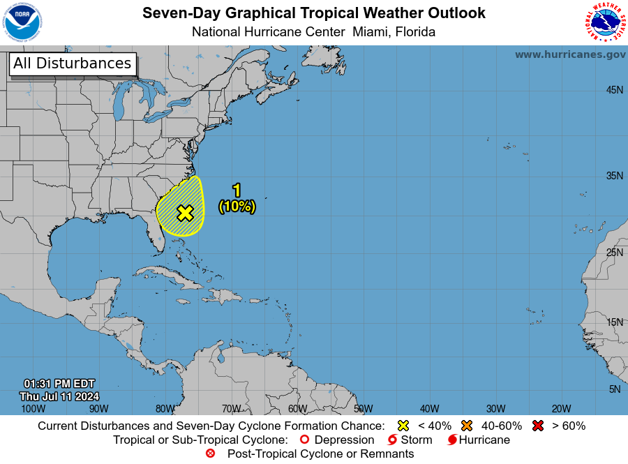
TROPICS: A broad area of low pressure located a few hundred miles off the southeastern U.S. coast continues to produce disorganized showers and thunderstorms. This system has not become any better organized today, and environmental conditions do not appear favorable for development before it moves inland over the southeastern U.S. by this weekend. Regardless of development, heavy rainfall will be possible for portions of the Carolina coast late this week into the weekend. The chance of development is only 10 percent, and the rest of the Atlantic basin is very quiet.
DROUGHT MONITOR: The new drought monitor released today shows 38 percent of Alabama in drought conditions. A “severe drought” (D2) is now defined for parts of the Tennessee Valley and West Alabama.
ON THIS DATE IN 1936: From July 5-17, temperatures exceeding 111 degrees in Manitoba and Ontario Canada claimed 1,180 lives (mostly the elderly and infants) during the most prolonged, deadliest heat wave on record. Four hundred of these deaths were caused by people who drowned seeking refuge from the heat. In fact, the heat was so intense that steel rail lines and bridge girders twisted, sidewalks buckled, crops wilted and fruit baked on trees.
ON THIS DATE IN 1980: Birmingham’s high was 102 degrees as the generational heat wave of 1980 intensified. Starting on July 10, Birmingham’s highs were 101, 102, 104, 106, 103, 102, 105, 105. The hottest day of the summer was July 17 when over 80 percent of the state reached 100 degrees, and nearly one quarter of the state reached 105. The highest reading on that day was 108 degrees recorded in the cities of Bessemer, Aliceville, and Jasper. It was 105 in Birmingham that day. In the month of July alone, there was an estimated 120 heat-related deaths along with the loss of more than 200,000 chickens and half the state’s corn crop. Around the nation, the heat wave claimed anywhere between 1,250 and 10,000 lives.
Look for the next video briefing here by 6:00 a.m. tomorrow…
Category: Alabama's Weather, ALL POSTS, Weather Xtreme Videos
About the Author (Author Profile)
James Spann is one of the most recognized and trusted television meteorologists in the industry. He holds the AMS CCM designation and television seals from the AMS and NWA. He is a past winner of the Broadcast Meteorologist of the Year from both professional organizations.Subscribe
If you enjoyed this article, subscribe to receive more just like it.


