Midday Nowcast: Hot and Dry Pattern; Drought Increasing Across Alabama
HOT AND DRY WEATHER: Highs today are in the lower 90s, and lower humidity levels will keep it dry. Most of the state will be dry tomorrow with highs climbing into the mid 90s. Dry air stays in place, and the weekend looks generally rain-free with a good supply of sunshine both days. We will mention just a small risk of a shower late Sunday, but the main story this weekend will be the temperatures, as upper 90s are expected across Alabama and I would not be surprised to see some areas hit the century mark.
BIRMINGHAM ALMANAC: For July 11th, the average high for Birmingham is 91° and the average low is 72°. The record high is 103° set in 1901, while the record low is 58° set in 1963. We average 0.18” of precipitation on this date, and the record value is 2.84” set in 1903.
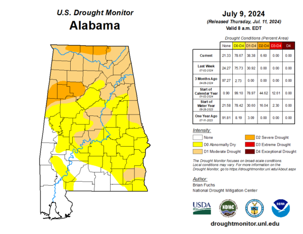
DROUGHT MONITOR: The latest drought monitor out this morning, shows a very dry Alabama. Severe drought conditions have developed over Walker, Fayette, Lamar, and portions of Tuscaloosa, Marion, and Pickens Counties in West Alabama. While portions of Lauderdale, Limestone, Madison, and Jackson Counties in the Tennessee Valley are seeing it too. Moderate drought covers the northern third of Alabama, with Abnormally Dry Conditions for most of Central and Southeast Alabama. Southwest Alabama is in decent shape right now as far as drought conditions.
USA BRIEF: Extremely dangerous heat continues in the Western U.S. the rest of the week with widespread Excessive Heat Warnings and Heat Advisories. Hazardous heat will expand in coverage over portions of the central and eastern U.S. late this weekend into next week, with the heat expected to persist longer over portions of the southeastern U.S. and the East Coast.
NEXT WEEK: For now the weather looks very routine for mid-summer. Partly sunny, hot, humid days with “scattered, mostly afternoon and evening showers and thunderstorms” on a daily basis. Highs in the mid to upper 90s, lows in the 70s.
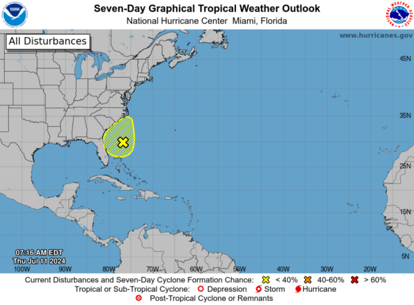
IN THE TROPICS: Off the Southeastern U.S. Coast, a broad area of low pressure located a few hundred miles off the southeastern U.S. coast continues to produce disorganized showers and thunderstorms. Environmental conditions do not appear favorable for much additional development of this system over the next day or two before it moves inland over the southeastern U.S. by this weekend. Regardless of development, heavy rainfall will be possible for portions of the Carolina coast late this week into the weekend. For more information about the potential for heavy rainfall, see products issued by the Weather Prediction Center and your local National Weather Service office. Formation chance through 7 days…low…10 percent.
Next name up is Debby.
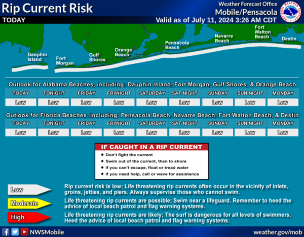
BEACH FORECAST CENTER: Highs in the upper 80s and low 90s with storms on a daily basis. Water temperatures are very warm with mid-80s being reported up and down the Northern Gulf Coast. PLEASE pay attention to the Rip Current Flag System at each beach. Get the latest weather and rip current forecasts for the beaches from Fort Morgan to Panama City on our Beach Forecast Center page. There, you can select the forecast of the region that you are interested in visiting.
WORLD TEMPERATURE EXTREMES: Over the last 24 hours, the highest observation outside the U.S. was 122.9F at Nasiriya, Iraq. The lowest observation was -101.4F at Vostok, Antarctica.
CONTIGUOUS TEMPERATURE EXTREMES: Over the last 24 hours, the highest observation was 128F at Death Valley, CA. The lowest observation was 30F at Peter Sinks, UT.
Category: Alabama's Weather, ALL POSTS


