
Tracking Beryl: Getting Better Organized, Tropical Storm Warnings Issued
The satellite presentation of Tropical Storm Beryl looks more organized this morning. There has been a strong burst of convection since the pre-dawn hours.
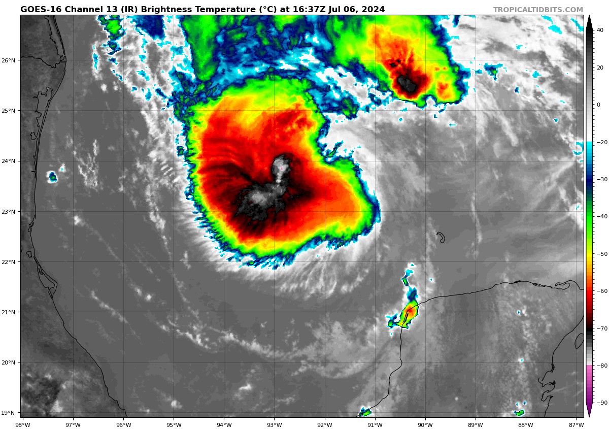
The center of the cyclone is 460 miles southeast of Corpus Christi TX. Its forward speed has slowed to 12 mph. in a direction of 300 degrees, or west northwest.
The AF plane is finding pressures around 997-999 mb. The inner core will be slow to reorganize although the crew did report eyewall was 40% reformed.
Top winds are 60 mph. It will become a hurricane Sunday evening while east of Brownsville TX. It should intensify to 85 or 90 mph before making landfall Monday morning between Rockport, Port Lavaca, and Palacios.
Tropical storm winds will reach the coast of South Padre Island from Port Isabel to Corpus Christi by 10 p.m. Sunday evening. Tropical storm warnings are in effect now from the Rio Grande to baffin Bay, which is south of Corpus. The hurricane watch is from the Rio Grande all the way to San Luis Pass. The storm surge watch goes from the Rio Grande to High Island, which is east of Galveston.
Tropical storm force winds will gradually move onshore up the coast to Freeport through the pre-dawn hours. Strong tropical storm force winds 58 mph or greater will begin to come onshore between Rockport and Palacios around sunrise Monday with hurricane force winds following shortly afterward. Landfall should occur around 10-11 a.m. Monday along Matagorda Island. The hurricane force winds will spread inland during the late morning and afternoon hours, reaching inland to about Port Lavaca a the storm begins to weaken. It could stay stronger a little longer than expected if the brown ocean effect comes into play. That is where a strom can maintain strength over land after landfall due to copious amounts of moisture and less frictional effects.
Tornadoes are possible tomorrow starting around noon and Monday in the feeder bands as they come onshore along the middle texas coast between Corpus Christi and Houston. path
Storm surge is expected to reach 3-5 feet between Baffin Bay and San Luis Pass, including Baffin, Corpus Christi, and Matagorda Bays. It will reach 2-4 feet in the Laguna Madre south of Baffin Bay and from San Luis Pass through Galveston Bay.
Rainfall will reach 8-12 inches along and east of the path of the center from the Middle Texas Coast between Victoria and Bay City northward to College Station. The Houston Metro will get 4-8 inches. Flooding will be a problem.
About the Author (Author Profile)
Bill Murray is the President of The Weather Factory. He is the site's official weather historian and a weekend forecaster. He also anchors the site's severe weather coverage. Bill Murray is the proud holder of National Weather Association Digital Seal #0001 @wxhistorianSubscribe
If you enjoyed this article, subscribe to receive more just like it.


