

Mostly Dry Tomorrow; Scattered Storms Around Wednesday Through Friday
DRY AIR: A nice push of dry air and lower dew points is over the northern half of Alabama this afternoon. Even in South Alabama showers are almost impossible to find at mid-afternoon; temperatures are mostly in the 90s. A few scattered strong thunderstorms remain possible across the southeast corner of the state through the evening hours. Otherwise, tonight will be fair with lows generally in the 68-75 degree range.
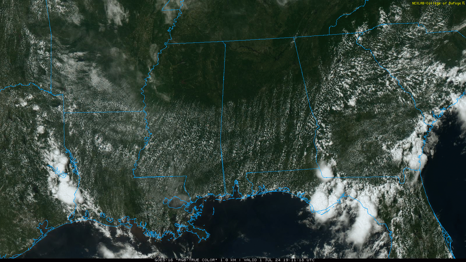
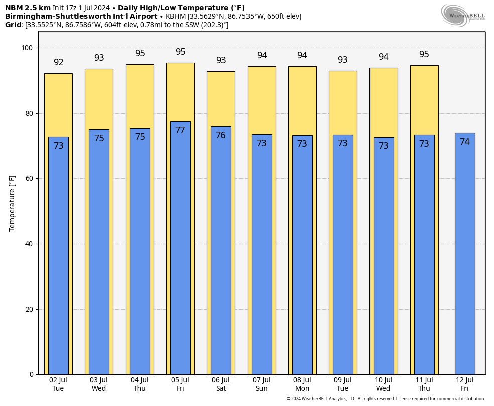
Not much change tomorrow; afternoon showers will be very hard to find with highs mostly in the mid 90s.
Scattered showers and storms will become more numerous across Alabama Wednesday through Friday as the air becomes more unstable, and moisture levels rise. The chance of any one spot getting wet these days is 30/40 percent, and highs will remain in the 90s.
THE ALABAMA WEEKEND: Classic summer weather continues. Partly sunny, hot, humid days with “scattered, mostly afternoon and evening showers and thunderstorms” Saturday and Sunday. Highs in the 92-96 degree range.
And, no real change next week as we roll with a persistence forecast. Hot, humid, a few spotty showers and thunderstorms around on a daily basis with highs in the 90s and lows in the 70s. See the video briefing for maps, graphics, and more details.
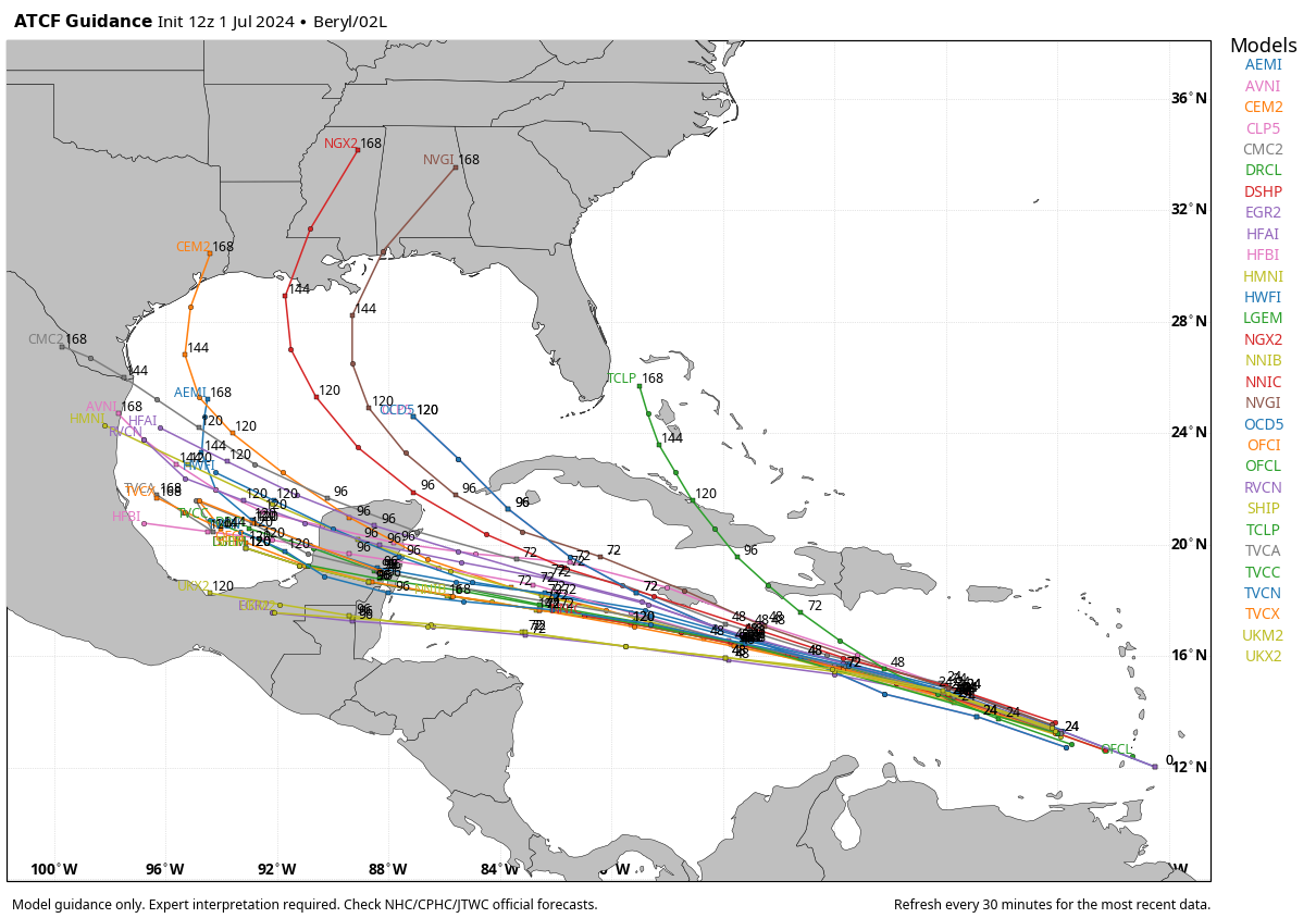
TROPICS: Hurricane Beryl now in the Caribbean west of the Windward Islands with winds of 150 mph, just under category five strength. Slow weakening is likely over the next few days due to westerly shear; the hurricane will be near or just south of Jamaica Wednesday, and should move into northern Belize or Mexico’s Yucatan Peninsula Friday morning.
It will weaken to a tropical storm over land before moving into the Bay of Campeche Friday night. From there, there is considerable model spread, with some ensemble members taking the system westward into Mexico, and others suggesting a northward turn toward Texas or even Louisiana. Beryl’s final destination will be determined by the upper air pattern and the strength and depth of the system; it is simply too early to call for now. The chance of direct impact for the Central Gulf Coast (Gulf Shores to Panama City Beach) remains low at this point.
ON THIS DATE IN 2002: San Antonio, Texas recorded 9.52 inches of rain on this day to set a new record for its greatest rainfall for the entire month of July.
Look for the next video briefing here by 6:00 a.m. tomorrow…
Category: Alabama's Weather, ALL POSTS, Weather Xtreme Videos
About the Author (Author Profile)
James Spann is one of the most recognized and trusted television meteorologists in the industry. He holds the AMS CCM designation and television seals from the AMS and NWA. He is a past winner of the Broadcast Meteorologist of the Year from both professional organizations.Subscribe
If you enjoyed this article, subscribe to receive more just like it.


