
Eye of Beryl over Carriacou in the Grenadines
Here is a spectacular radar image from Barbados of Beryl moving through the Windward Islands this morning.
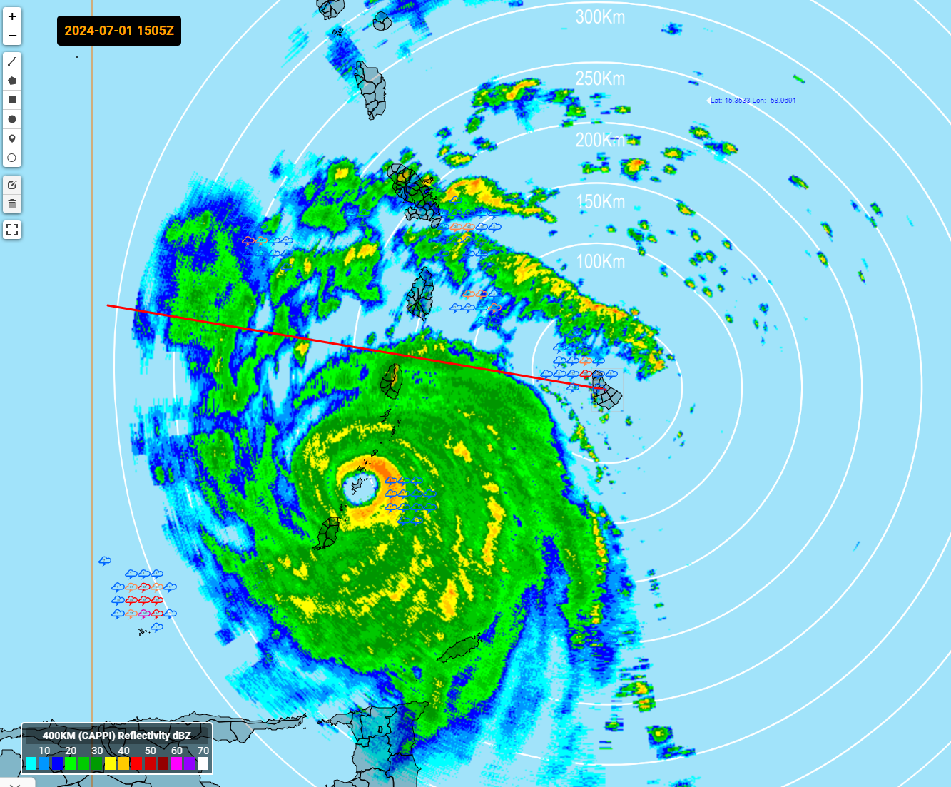
The eye is now passing over the island of Carriacou. It has a population of 10,000. It has one of the most beautiful beaches in the Caribbean.
The storm has become larger and appears to be strengthening again on satellite.
AF reconnaissance found a lower central pressure on this last pass dropping from 960 to 956 mb. And they observed a flight level wind of 132 knots…or 137 mph adjusted for altitude. The SFMR reported a surface wind of 149 knots…171 mph.
Point Salines Airport on Grenada, on the south side of the eye, is reporting rain, 77F/77F, wind WSW 28 knots gusting to 45 knots (52 mph). Pressure is 1003 mb.
Argyle International on St. Vincent stopped reporting at 6 p.m. last evening. They are just north of the eyewall.
Barbados has been taking a beating. It has been a long, long night there. Grantley Adams International reported a could of gusts to 69 mph around sunrise this morning. The winds are gradually diminishing now as the hurricane passes off the south southwest. The airport is at 168 feet. Their lowest SLP was 29.74 inches. The barometer in the center of the storm is 28.23 inches.
About the Author (Author Profile)
Bill Murray is the President of The Weather Factory. He is the site's official weather historian and a weekend forecaster. He also anchors the site's severe weather coverage. Bill Murray is the proud holder of National Weather Association Digital Seal #0001 @wxhistorianSubscribe
If you enjoyed this article, subscribe to receive more just like it.


