

Forecast Notes and Radar Update
Heat indices still running high across Central Alabama…
103F at Birmingham, Tuscaloosa, and Bessemer. It is 101F at Alex City, 106F at Auburn…107F at Maxwell, 109F at Dannelly, 112F at Selma, and 205F at Demopolis. Heat advisories remain in effect until 9 p.m.
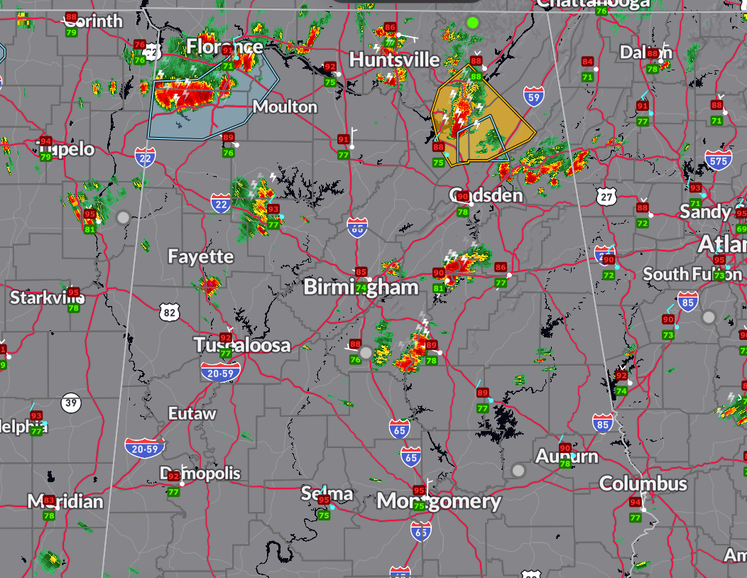
Strongest storms are over Calhoun and Cleburne Counties, around Jacksonville and Weaver.
Strong storms are south of Triana in Morgan County moving toward Arab.
Another strong storm is moving into Marion County in Northwest Alabama.
This activity will continue pushing southeast but is expected to weaken slowly over the next few hours.
MY FORECAST NOTES
MONDAY
High 93 under mostly sunny skies. Lower dewpoints so no heat advisories North or North Central. Heat indices will be between 103-109F near and south of US-80 or south of Montgomery.
TUESDAY
A few luck spots wake up to morning readings in the 60s! But dewpoint bounce back into the 70s.
WEDNESDAY
A few showers and thunderstorms return.
THURSDAY
Isolated showers and storms.
FRIDAY
Cold front approaching from the north. Widely scattered showers and storms.
SATURDAY
Boundary settles into North Alabama…scattered showers and storms.
SUNDAY
Afternoon showers and storms likely.
Category: Alabama's Weather, ALL POSTS
About the Author (Author Profile)
Bill Murray is the President of The Weather Factory. He is the site's official weather historian and a weekend forecaster. He also anchors the site's severe weather coverage. Bill Murray is the proud holder of National Weather Association Digital Seal #0001 @wxhistorianSubscribe
If you enjoyed this article, subscribe to receive more just like it.


