
Beryl 10 a.m. Advisory: Beryl Now a Dangerous Category Four Hurricane
Here are the fast facts on Beryl at 10 a.m. CDT:
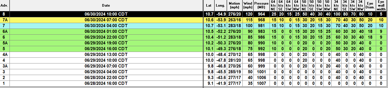
SUMMARY OF 1100 AM AST…1500 UTC…INFORMATION
———————————————–
LOCATION…10.7N 54.9W
ABOUT 355 MI…570 KM ESE OF BARBADOS
ABOUT 470 MI…755 KM E OF GRENADA
MAXIMUM SUSTAINED WINDS…120 MPH…195 KM/H
PRESENT MOVEMENT…W OR 275 DEGREES AT 21 MPH…33 KM/H
MINIMUM CENTRAL PRESSURE…964 MB…28.47 INCHES
There are two Hurricane Hunter Missions in Hurricane Beryl at this hour.
The NOAA plane found a central pressure around 964 mb and flight level winds of over 110 knots or about 115 mph. The SFMR instrument estimated surface winds at 115 knots or 132.5 mph. The Air Force mission found about the same conditions about 20 minutes later.
The winds in the storm have increased 55 mph in 24 hours, easily satisfying the criteria for rapid intensification of 35 mph in 24 hours.
Beryl is now forecast to reach 140 mph in intensity later today and tonight.
The storm is small, but its wind field is expanding. Hurricane force winds extend out 15-25 miles from the center. Tropical storm force winds extend out 70-100 mph. here is lots of lightning around the eyewall, indicating significant strengthening is still underway.
The hurricane will pass near or south of Barbados and near or north of Tobago about 2-3 a.m. CDT early Monday (late tonight). The eye and eyewall will pass over the Grenadines and Grenada around 9-10 a.m.
Of course, the NHC mean track error at 24 hours is 38.5 miles, so the eye could could pass over Grenada or over St. Vincent just as well.
The eye right now is clearly evident on satellite. The Hurricane Hunters found a closed eye 18 nautical miles in diameter. The temperature in the eye is 5 degrees C warner than outside the eye.
The hurricane should weaken a bit over the Caribbean, but it still will be a major hurricane in 5 days when it reaches the Yucatan.
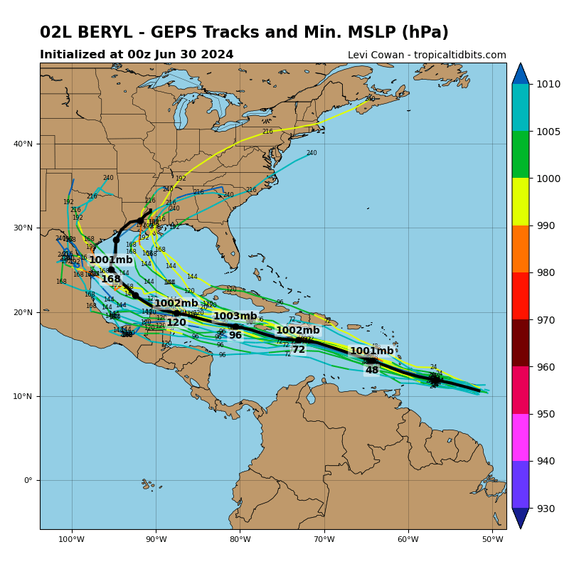
Both sets of ensembles this morning have shifted the eventual track up into the Gulf. The European with a landfall in Texas or southwestern Louisiana next weekend. But that is a long way away. The European has an eventual track to the Upper Texas Coast or southwestern Louisiana. The GFS ensembles aim it toward Texas. The majority of the deterministic models are pushing the track up into the western Gulf.
About the Author (Author Profile)
Bill Murray is the President of The Weather Factory. He is the site's official weather historian and a weekend forecaster. He also anchors the site's severe weather coverage. Bill Murray is the proud holder of National Weather Association Digital Seal #0001 @wxhistorianSubscribe
If you enjoyed this article, subscribe to receive more just like it.


