Severe Thunderstorm Warnings for Tuscaloosa County as well Greene and Sumter Counties
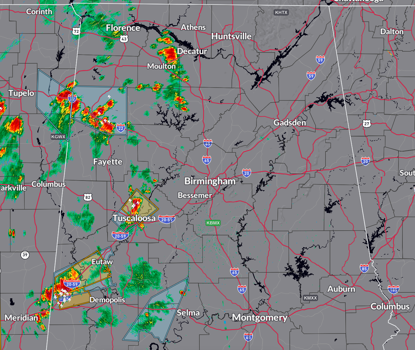
Severe thunderstorm warning for Tuscaloosa County til 3 p.m.
Winds gusted to 68 mph at the Tuscaloosa Airport at 2:20 p.m.
Strong storms extend along US-43 and AL-69 North of Tuscaloosa/Northport across the cities of Tuscaloosa and Northport with a strong storm near Skyland Blvd down US-82 to Sherwood Forest.
These storms are capable of winds to 70 mph and small hail.
—–
There is a severe thunderstorm warning for parts of Greene and Sumter Counties until 3 p.m., and another warning was just issued for parts of Sumter County until 315 p.m.
Dangerous storms along I-59/20 from west of Epes to Livingston to York.
Places like Boligee and Eutaw will be affected, as well as rural Sumter County to the south of Linvingston.
Additional strong storms are west of Valley Grande and Selma.
Scattered storms are over Northwest Alabama.
To the west, A QLCS or line of storms is moving through northern Mississippi, southeastern Arkansas, and northern Louisiana. This activity will spread southeastward across Mississippi. A severe thunderstorm watch could be issued later. These storms will get into West Alabama around 6 p.m.
Additional waves of storms will enter Alabama overnight, but they all weaken as they et to I-59.
Category: Alabama's Weather, ALL POSTS, Severe Weather
About the Author (Author Profile)
Bill Murray is the President of The Weather Factory. He is the site's official weather historian and a weekend forecaster. He also anchors the site's severe weather coverage. Bill Murray is the proud holder of National Weather Association Digital Seal #0001 @wxhistorianSubscribe
If you enjoyed this article, subscribe to receive more just like it.


