

Dry Days Ahead; Rising Heat Levels Later This Week
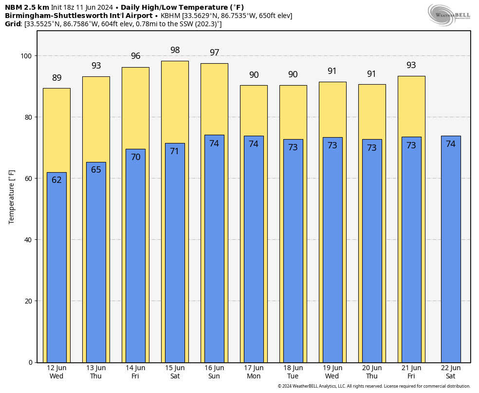
VERY PLEASANT JUNE DAY: Temperatures are in the 80s across most of Alabama this afternoon with a sunny sky. Readings are near 90 down around Mobile and Dothan. Humidity levels are low, and tonight will be fair and very pleasant with a low in the 57-64 degree range.
REST OF THE WEEK AND THE WEEKEND: Rising heat levels will headline the forecast with mostly sunny days and fair nights through Saturday. The high tomorrow will be in the 87-91 degree range, followed by mid 90s Thursday, and mid to upper 90s Friday through Sunday. Some spots could flirt with the 100 degree mark; heat index values will be over 100. Easily the hottest weather so far this year.
There will be some increase in moisture Sunday, but for now it looks like any showers will be confined to the southern quarter of Alabama.
NEXT WEEK: We will use the reliable European global model in the forecast, which suggests generally dry weather continuing across the state for much of the week. A few showers are possible Monday and Tuesday, mainly over the southern counties. Heat levels fall with highs generally in the low 90s. See the video briefing for maps, graphics, and more details.
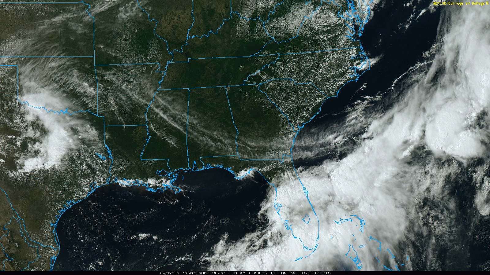
TROPICS: A broad area of low pressure over the eastern Gulf of Mexico is producing a large area of disorganized showers and thunderstorms. This system is expected to move northeastward across the Florida Peninsula during the next day or so and move offshore of the U.S. Southeast coast later this week. Environmental conditions are expected to be generally unfavorable, although some slow development is possible when the system is offshore of the U.S. Southeast coast. Regardless of development, heavy rainfall is already occurring and is expected to continue across portions of the Florida Peninsula (not the panhandle) during the next few days.
This feature will not impact the central Gulf Coast (Gulf Shores to Panama City Beach).
ON THIS DATE IN 1990: One of the most expensive hailstorms in U.S. history occurred as $625 million of damage was caused along the Colorado Front Range from Colorado Springs to Estes Park. Golf to baseball sized hail fell along with heavy rain. 60 people were injured in the storm.
Look for the next video briefing here by 6:00 a.m. tomorrow…
Category: Alabama's Weather, ALL POSTS, Weather Xtreme Videos
About the Author (Author Profile)
James Spann is one of the most recognized and trusted television meteorologists in the industry. He holds the AMS CCM designation and television seals from the AMS and NWA. He is a past winner of the Broadcast Meteorologist of the Year from both professional organizations.Subscribe
If you enjoyed this article, subscribe to receive more just like it.


