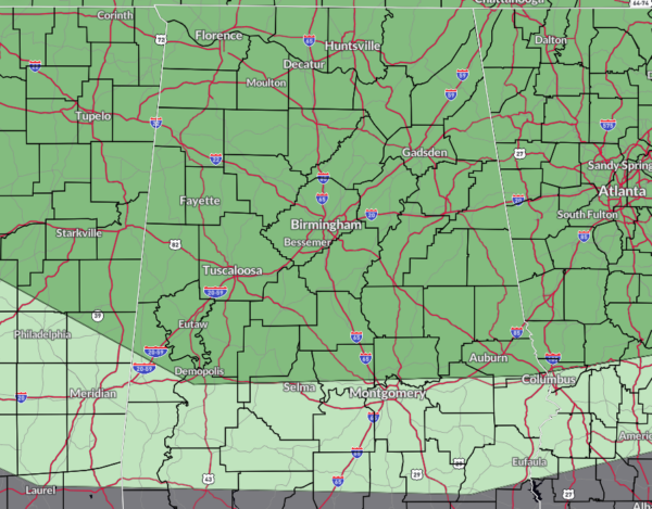
Marginal Risk Introduced for Much on North/Central Alabama on Sunday
Marginal Risk for Severe Storms Introduced for Sunday!
Get ready, folks! Sunday’s weather is shaping up to be active. Here’s what you need to know:
Morning Showers & Storms: A mid-level disturbance will sweep through Tennessee, far northern Alabama, and far northern Georgia, bringing isolated showers and thunderstorms, especially near and north of the I-20 corridor.
Afternoon Activity: Another disturbance will move southeast from the Central Plains, sparking more showers and storms across our northern and central counties by mid-afternoon.
Hot and Humid: With highs in the 90s and rising dew points, we’re looking at plenty of low-level instability. This means some of these storms could turn strong to severe. Winds will be from the southwest to west at 5-10 mph. Highs will range from around 90°F in the far north and higher elevations to the mid-90s in the south, west, and central areas.
Marginal Risk: All of North Alabama and much of Central Alabama to as far south as Livingston, Uniontown, Prattville, and just north of Phenix City.
Storm Timing and Threats: The threat window is roughly from 3pm Sunday afternoon into the evening hours, possibly ending by 9pm. Threats include damaging winds up to 60 mph and a very small chance of large hail.
Severe Storm Risk: Models suggest a couple of severe thunderstorms could linger into Sunday evening.
Stay safe and keep checking back with the AlabamaWx Weather Blog!
Category: Alabama's Weather, ALL POSTS, Severe Weather


