EXPIRED Severe T-Storm Warning — Parts of Bibb, Chilton, Jefferson, Shelby, Tuscaloosa, Walker Co. Until 8 pm
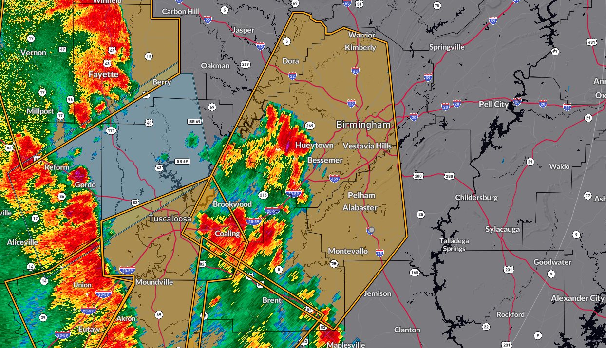
The National Weather Service in Birmingham has issued a Severe Thunderstorm Warning for southeastern Walker County, north central Chilton County, eastern Tuscaloosa County, western Shelby County, Bibb County, and Jefferson County, all in central Alabama. This warning is in effect until 8:00 PM CDT. At 6:58 PM CDT, severe thunderstorms were located along a line extending from near Concord to near Centreville, moving northeast at 45 mph. The storms are capable of producing 60 mph wind gusts, as indicated by radar. These winds can cause damage to roofs, siding, and trees.
Areas that may be affected include Birmingham, southeastern Tuscaloosa, Hoover, Vestavia Hills, Alabaster, Bessemer, Homewood, Pelham, Mountain Brook, Helena, Hueytown, Gardendale, Irondale, Calera, Fairfield, Chelsea, Fultondale, Montevallo, Brent, and Columbiana. Residents in these locations are advised to move to an interior room on the lowest floor of a building for protection.
Category: Alabama's Weather, ALL POSTS, Severe Weather
About the Author (Author Profile)
Scott Martin is an operational meteorologist, professional graphic artist, musician, husband, and father. Not only is Scott a member of the National Weather Association, but he is also the Central Alabama Chapter of the NWA president. Scott is also the co-founder of Racecast Weather, which provides forecasts for many racing series across the USA. He also supplies forecasts for the BassMaster Elite Series events including the BassMaster Classic.Subscribe
If you enjoyed this article, subscribe to receive more just like it.


