Alabama Update at 9:30 p.m.
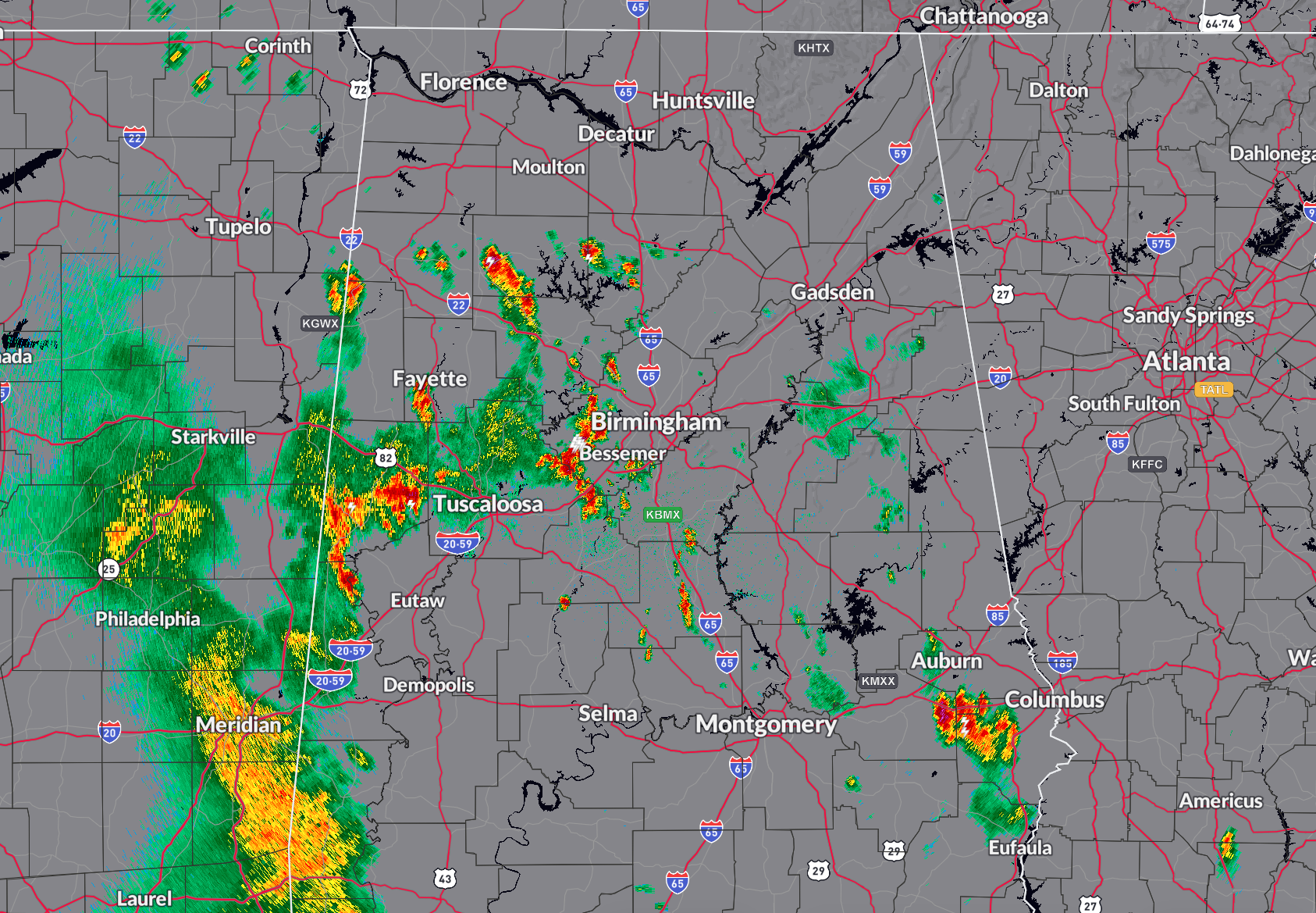
Showers and storms continue across North Central and West Central Alabama tonight ahead of an approaching wave.
Showers and storms cover parts of Lamar, Fayette, Walker, Winston, Cullman, Jefferson, Tuscaloosa, Bibb, Pickens, and Sumter Counties.
A few showers extends from near McCalla back into Chilton County, and over to South of Auburn over Macon and Russell Counties.
A mass of moderate rain extends from Louisville to Meridian to Waynesboro in Mississippi. This activity will continue to pivot northeastward across West Central Alabama over the next couple of hours weakening as it goes.
More showers and storms will develop after midnight as an upper level disturbance spins across Alabama. There could two waves: one from Montgomery up to Auburn between 4 am and 10 am, and another approaching the I-65 corridor between Birmingham and Huntsville between 9 a.m. and noon. There will be lightning, gusty winds, and some heavy rain, but I don’t think the storms look severe. But we will be watching.
Category: Alabama's Weather, ALL POSTS, Severe Weather
About the Author (Author Profile)
Bill Murray is the President of The Weather Factory. He is the site's official weather historian and a weekend forecaster. He also anchors the site's severe weather coverage. Bill Murray is the proud holder of National Weather Association Digital Seal #0001 @wxhistorianSubscribe
If you enjoyed this article, subscribe to receive more just like it.


