
Midday Nowcast: Looks and Feels Like Summer
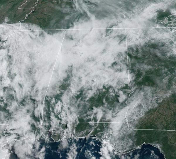
Routine early summer weather for Alabama through Wednesday with partly sunny days and random, scattered, mainly afternoon and evening showers and storms each day. The chance of any one spot getting wet daily is 30-40%, with the greatest coverage between the hours of 2PM-10PM each day. Highs will be in the mid to upper 80s.
BIRMINGHAM ALMANAC: For June 3rd, the average high for Birmingham is 86° and the average low is 66°. The record high is 99° set in 2011, while the record low is 46° set in 1956. We average 0.15” of precipitation on this date, and the record value is 2.55” set in 1909.
ACROSS THE USA: Strong to severe thunderstorms are possible from much of the Mississippi Valley into the Ozark Plateau and southern Plains Monday while heavy to excessive rainfall may bring flooding to parts of the southern Plains and Ozarks. Areas of heavy rain and strong winds are ongoing in the Pacific Northwest. Later this week, a heat wave will impact the southwest U.S. and California Central Valley.
LATE WEEK FRONT: Scattered showers and storms could be a little more numerous Thursday with a weak front moving through the state, then we trend toward drier weather for the weekend. Friday through Sunday look relatively dry with the risk of showers very low over these three days. Expect a good supply of sunshine all three days with highs in the mid to upper 80s.
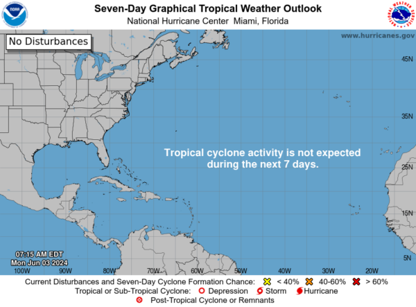
IN THE TROPICS: For the North Atlantic, Caribbean Sea, and the Gulf of Mexico: Tropical cyclone formation is not expected during the next seven days.
BEACH FORECAST CENTER: Get the latest weather and rip current forecasts for the beaches from Fort Morgan to Panama City on our Beach Forecast Center page. There, you can select the forecast of the region that you are interested in visiting.
WORLD TEMPERATURE EXTREMES: Over the last 24 hours, the highest observation outside the U.S. was 121.5F at Bandar-E-Dayyer, Iran. The lowest observation was -91.1F at Concordia, Antarctica.
CONTIGUOUS TEMPERATURE EXTREMES: Over the last 24 hours, the highest observation was 112F at Rio Grande Village, TX. The lowest observation was 24F at Angel Fire, NM.
Category: Alabama's Weather, ALL POSTS
About the Author (Author Profile)
Macon, Georgia Television Chief Meteorologist, Birmingham native, and long time Contributor on AlabamaWX. Stormchaser. I did not choose Weather, it chose Me. College Football Fanatic. @Ryan_StinnetSubscribe
If you enjoyed this article, subscribe to receive more just like it.


