
Noon Update: Clouds in the Birmingham/Anniston Areas, Partly Cloudy Most Everywhere Else
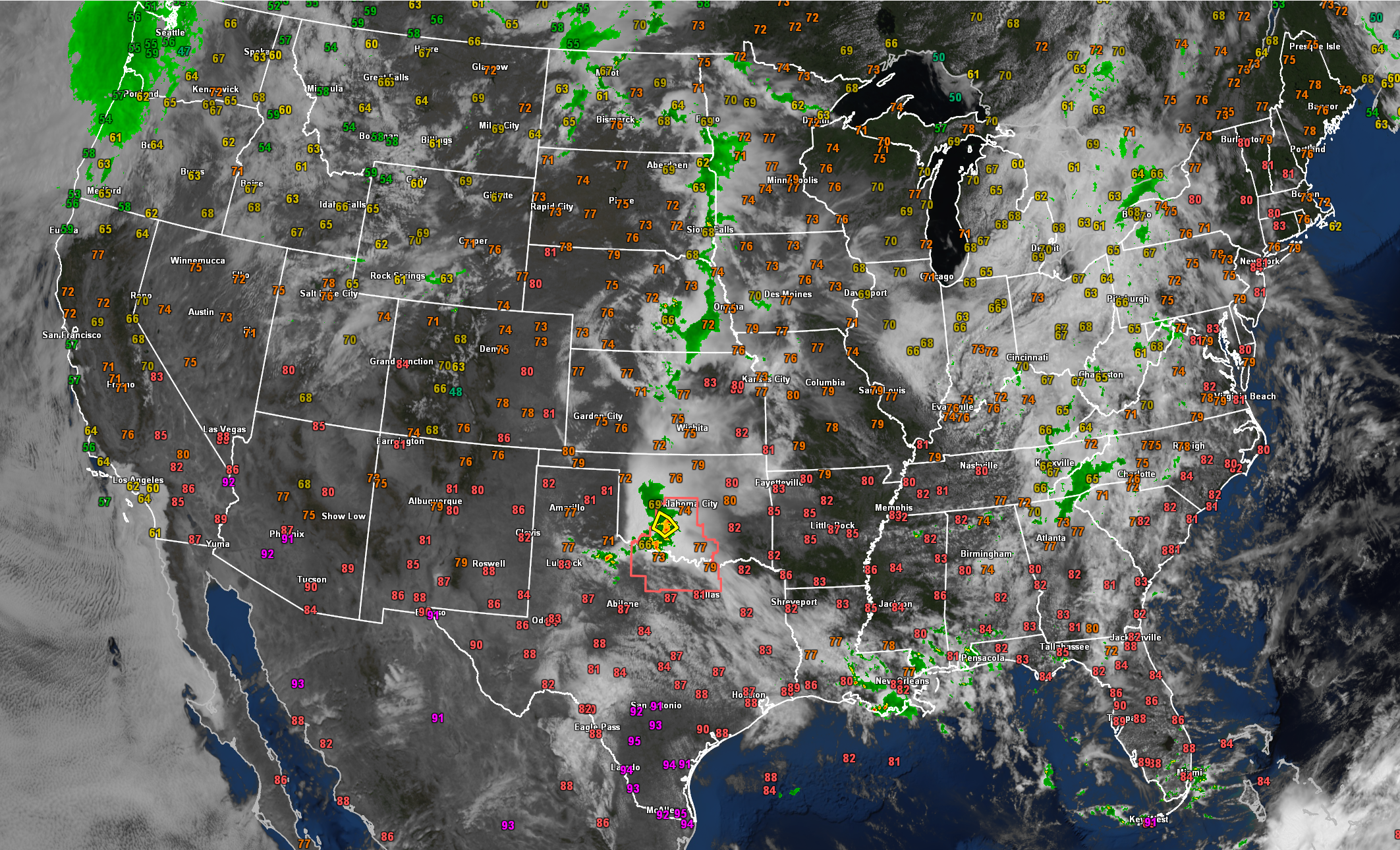
Looking at the old big blue marble this Sunday morning, a mass of clouds covers much of the eastern United States, thanks to a weak trough that extends from Ohio down into Alabama. The disturbance that brought us rain overnight is moving through eastern Tennessee, with some showers in the Carolinas and Georgia.
Many showers and storms are lined up from the northern Plains through the central Plains and into Oklahoma. Severe thunderstorm warnings are in effect along the Red River between Texas and Oklahoma, and the SPC just issued a watch as those storms are expected to strengthen. The watch includes Vernon, Texas, Lawton, Ardmore, Wichita Falls, Denton, Sherman, and Jacksboro. A few severe thunderstorms are already in effect. Rainfall could be excessive in spots in the thunderstorm areas.
We are free of severe weather today through Tuesday according to the SPC.
The Plains mostly monopolize the severe weather risk today, with the highest risk in the Elevated category (level 3 of 5). The risk bleeds over across southeastern Texas into the southwestern half of Louisiana.
A big mass of rain is moving onshore of Oregon and Washington in the Pacific Northwest.
The forecast in Alabama was well-behaved, sticking to what the convection-allowing models predicted. A flash flood warning was required for parts of Lamar, Fayette, Walker, and southern Marion Counties, with 5-6 inches of rain falling over southeastern Marion and western Walker Counties, but no flooding issues were reported at least.
Skies are mostly cloudy across parts of Central Alabama with partly cloudy elsewhere. A few shower and storms were forming over the Tennessee Valley. There are a few showers south of Lake Logan Martin and in Hale County southeast of Moundville.
Showers should be isolated at best through tonight for North and Central Alabama. They will be more widespread over South Alabama. Same for Monday, just widely scattered showers during the day, with a few larger showers moving into South Central Alabama Monday evening.
Highs this afternoon will mostly be in the 80s. If any areas maintain cloudiness, they will be a little cooler. Birmingham is at 76F this hour. Muscle Shoals is already at 82F.
Category: Alabama's Weather, ALL POSTS, Severe Weather
About the Author (Author Profile)
Bill Murray is the President of The Weather Factory. He is the site's official weather historian and a weekend forecaster. He also anchors the site's severe weather coverage. Bill Murray is the proud holder of National Weather Association Digital Seal #0001 @wxhistorianSubscribe
If you enjoyed this article, subscribe to receive more just like it.


