
The Midday Report — A Few Strong/Severe Storms Remain Possible Through the Day
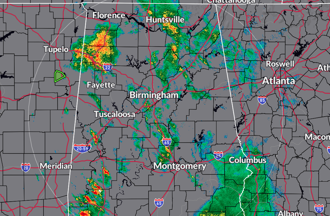
We have some scattered showers and some thunder out there across portions of North/Central Alabama as we have hit the 11 am hour on this first day of June. So far, all activity has remained well-behaved. However, we are still looking for the possibility of a few stronger to possibly severe storms this afternoon and into the evening.
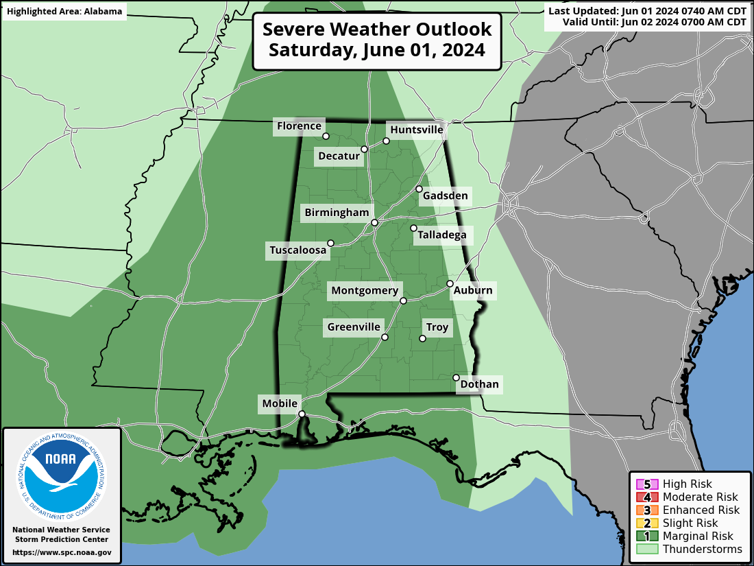
The SPC continues a Marginal Risk for locations west of a line from just east of Gadsden to Auburn to just west of Eufaula. Strong to damaging winds will be the main threat today, especially from now through 9pm tonight. There will be no organized line of storms today, but we’ll have scattered storms move slowly across the area. We may see some minor flood issues under the stronger storms, especially for the extreme southeastern locations (along and south of I-85). We’re in the lower 60s to the lower 70s at this point, but highs should reach the mid 70s to the lower 80s.
We’ll keep a good chance of scattered showers and storms from late-night tonight through the day on Sunday, but there will be no severe weather threat. Skies will be mostly cloudy when it is not raining in your location, with highs reaching the mid to upper 80s. It will feel muggy as dewpoints will be approaching or just over 70 degrees… just one of those words we do not like to hear in North/Central Alabama during this time of the year.

The tropics still remain calm, and just like this morning’s forecast briefing, no tropical systems are expected to form within the next seven days.
Category: Alabama's Weather, ALL POSTS, Severe Weather, Tropical
About the Author (Author Profile)
Scott Martin is an operational meteorologist, professional graphic artist, musician, husband, and father. Not only is Scott a member of the National Weather Association, but he is also the Central Alabama Chapter of the NWA president. Scott is also the co-founder of Racecast Weather, which provides forecasts for many racing series across the USA. He also supplies forecasts for the BassMaster Elite Series events including the BassMaster Classic.Subscribe
If you enjoyed this article, subscribe to receive more just like it.


