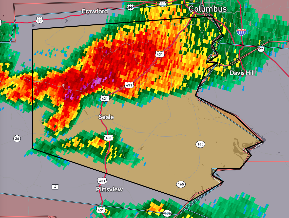
Severe Thunderstorm Warning for Russell County until 3 p.m.
The most dangerous part of the storm is approaching US-431 from Seale to the north.
Hail could be the size of quarters. The lightning flash rate is 35 flashes/min.
The bulk shear is definitely stronger at 54 mph. Lapse rates are steep, over 7C/km. CAPE is over 3,000 joules. SRH 0-1km is lower than expected for tornadoes, so damaging winds, and some hail are the main threats. PWATs are nearly 2″ so rain will be heavy.
The National Weather Service in Birmingham has issued a
* Severe Thunderstorm Warning for…
Central Russell County in southeastern Alabama…
* Until 300 PM CDT.
* At 212 PM CDT, a severe thunderstorm was located near Russell
County Sports Complex, or 13 miles southwest of Phenix City, moving
east at 40 mph.
HAZARD…60 mph wind gusts and quarter size hail.
SOURCE…Radar indicated.
IMPACT…Hail damage to vehicles is expected. Expect wind damage
to roofs, siding, and trees.
* Locations impacted include…
Russell County Sports Complex, Seale, Hatchechubbe, Uchee Creek,
Fort Mitchell, Fort Mitchell Activity Center, Phenix Drag Strip,
and Parkmanville.
PRECAUTIONARY/PREPAREDNESS ACTIONS…
For your protection move to an interior room on the lowest floor of a
building.
Category: Alabama's Weather, ALL POSTS, Severe Weather
About the Author (Author Profile)
Bill Murray is the President of The Weather Factory. He is the site's official weather historian and a weekend forecaster. He also anchors the site's severe weather coverage. Bill Murray is the proud holder of National Weather Association Digital Seal #0001 @wxhistorianSubscribe
If you enjoyed this article, subscribe to receive more just like it.


