
Strong Storms Moving into Georgia, More Storms Possible Through the Day over Central and South Alabama
Skies are variably cloudy over Alabama on this Memorial Day. You can see a large storm in visible satellite imagery over Chambers County in East Central Alabama. Heavy rain extends from Valley back across I=85 to the Oak Bowery community along US-431. A few showers extend from there back across US-80 between Camp Hill and Waverly and on to the west of Lake Martin near the Bulgers community. Camp Hill has picked up some heavy rain from the morning storms, with perhaps 3-4 inches across Lake Martin just to the west of there.
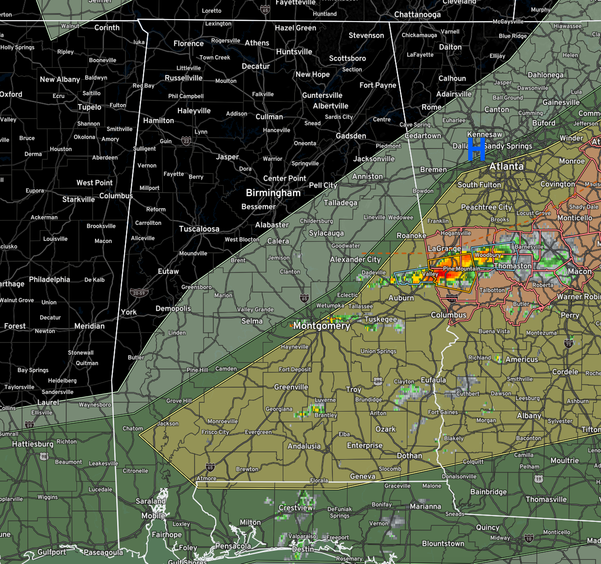
The storms that has moved into Harris County, Georgia just triggered a tornado warning from the NWS in Atlanta. it is near I-185 north of Clines Crossroads heading toward Pine Mountain Valley.
A few showers are forming across Lowndes, Autauga, Elmore, Montgomery, and Macon Counties. Not heavy yet.
A few showers are forming across Butler and Crenshaw Counties in South Alabama over to Barbour, Dale, and Henry Counties in Southeast Alabama.
No other storms are developing on satellite or radar right now.
Temperatures are mostly in the 70s and low 80s. Winds are light and southwesterly across the state.
A few isolated showers and storms will occur across Central Alabama this afternoon ahead of the cold front, with more widespread and heavier showers and storms over South Alabama later today.
There is still a slight risk (1/5) over areas southeast of a line from Atmore to Jackson, AL to Prattville, to Roanoke. Damaging winds and hail are the threats.
Category: Alabama's Weather, ALL POSTS, Severe Weather
About the Author (Author Profile)
Bill Murray is the President of The Weather Factory. He is the site's official weather historian and a weekend forecaster. He also anchors the site's severe weather coverage. Bill Murray is the proud holder of National Weather Association Digital Seal #0001 @wxhistorianSubscribe
If you enjoyed this article, subscribe to receive more just like it.


