
A Brief Check at 2am
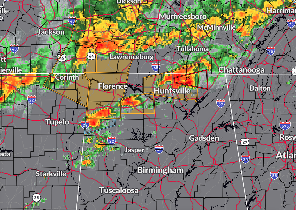
Strong to severe storms have developed out in front of the main squall line that is moving through South Tennessee at the moment. A possible brief spin-up tornado was indicated by radar by Moores Mill and was moving east at 45 mph. We also have several severe thunderstorm warnings for other batches of thunderstorms with damaging winds and large hail as the threats.
We continue to have plenty of instability and shear in place across North and northern Central Alabama to support severe thunderstorms and the potential for a few brief tornadoes.
Stay Weather Aware!
Category: Alabama's Weather, ALL POSTS, Severe Weather
About the Author (Author Profile)
Scott Martin is an operational meteorologist, professional graphic artist, musician, husband, and father. Not only is Scott a member of the National Weather Association, but he is also the Central Alabama Chapter of the NWA president. Scott is also the co-founder of Racecast Weather, which provides forecasts for many racing series across the USA. He also supplies forecasts for the BassMaster Elite Series events including the BassMaster Classic.Subscribe
If you enjoyed this article, subscribe to receive more just like it.


